Waquoit Bay
| Waquoit Bay | ||
|---|---|---|
| Waters | Atlantic | |
| Land mass | North America | |
| Geographical location | 41 ° 33 '36 " N , 70 ° 31' 48" W | |
|
|
||
| surface | 1.75 km² | |
| Tributaries | Quashnet River , Childs River , Red Brook | |
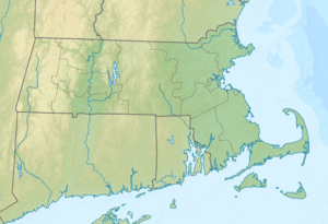
Waquoit Bay is an estuary on the south coast of Cape Cod in Massachusetts , United States . The area is designated as a public national estuary and serves as a research reserve. Waquoit Bay is part of the Nantucket Sound body of water and also forms the political boundary between the cities of Falmouth and Mashpee .
Surname
The name "Waquoit" comes from the Wampanoag word "Weeqayut" (Waquoit) meaning "Place of Light".
geography
The reserve extends over several sections. An eastern portion covers 432 acres (175 hectares) and includes South Cape Beach State Park , Sage Lot Pond, and Flat Pond . In the area of this area lies the beach, which is also a well-known fishing spot is, during the time of the annual Blue Fish - and Morone saxatilis (striped bass) -walks. The area is also an important breeding ground for protected bird species such as the yellow-footed plover (Charadrius melodus) and the American little tern (Sternula antillarum).
Sage Lot Pond ( ⊙ ) and Flat Pond ( ⊙ ) are saltwater lagoons that have been cut off from Nantucket Sound by spits .
The Quashnet River Property covers 361 acres (146 hectares) in the Quashnet River basin , north of the Bay. The river is the main inflow of fresh water and is mainly surrounded by higher-lying forests. In this area, a 5 km (3 mi ) hiking trail accompanies the river.
North Quashnet Woodlands covers 25 acres (10.1 hectares). This pine wood surrounds a drained cranberry swamp. Trout Unlimited has renatured the swamp drainage canal as a river.
Waquoit Bay itself has an area of 825 acres (334 hectares). It is almost completely cut off from the Nantucket Sound by spits. Only a narrow passage allows water to be exchanged during the course of the tides and a little further west there is another passage from Eel Pond ( Childs River ). Fresh water comes from four main sources: in addition to the Quashnet / Moonakis River, it is the Red Brook , Childs River, and groundwater sources.
To the east and north of the bay are other small tidal and freshwater pools that can be reached by kayak over the Seapit River , Great River and Little River : Hamblin Pond , (141 acres - 57 ha; ⊙ ), Jehu Pond (172 acres - 70 ha; ⊙ ), Abigail's Brook with Jim Pond ( ⊙ ); Bog Pond (2.8 acres - 1.1 ha; ⊙ ), Bourne Pond (10 acres - 4 ha; ⊙ ). Caleb Pond (5.7 acres - 2.3 hectares).
To the north are further protected areas: Mashpee National Wildlife Refuge , Frances A. Crane Wildlife Management Area , Mass Audubon Ashumet Holly Wildlife Sanctuary , Alper Conservation and John's Pond Park , as well as Mingo Conservation Area .
history
Washburn Island is a separate nature reserve within the bay. In World War II Washburn Iceland was the landing site for the Army Amphibious Command used. The camp was home to the 594th Engineer Boat and Shore Regiment .
In the early 1960s, the Norwegian explorer Johannes Kr. Tornöe investigated as a possible location of old Leifsbudir , the long-sought Nordic colony of Vinland .
National Marine Research Reserve
The United States Congress passed law in 1972 to assist marine states in protecting important stretches of coastline. The Coastal Zone Management Act made it possible to preserve estuary areas as natural field laboratories. Waquoit Bay is one of those zones. This also created the Visitor Center / Headquarters Property .
The Visitor's Center is an area of 28 acres (11 hectares). It is open all year round. There is a path from the center to the beach, where educational opportunities are often given.
Fauna & flora
Nesting aids for sea eagles have been set up in the area. Local fish species include blueback herring ( Alosa aestivalis ), brook trout ( brook trout ; Salvelinus fontinalis ), rainbow trout ( rainbow trout ; Oncorhynchus mykiss ), golden shiner ( Notemigonus crysoleucas ), banded killifish ( Fundulus diaphanus ) and northern pipefish ( Syngnathus fuscus ) Crustaceans are Callinectes sapidus ( blue crab ), hermit crabs and barnacles .
Individual evidence
- ↑ a b c d Waquoit bay national estuarine sanctuary draft environmental impact statement and draft management plan. US Department of Commerce, NOAA July 1984.

