
Watles
| Watles | ||
|---|---|---|
 |
||
| height | 2557 m slm | |
| location | Vinschgau , South Tyrol ( Italy ) | |
| Mountains | Sesvenna group | |
| Coordinates | 46 ° 43 '29 " N , 10 ° 29' 15" E | |
|
||
| Development | Chairlift | |
| Normal way | From Prämajur over the Plantapatsch hut and the south ridge | |

The Watles is a mountain ( 2557 m slm ) in the Sesvenna group in the upper Vinschgau , in the area of the municipality of Mals . South of the Watles lies the Schlinigtal , north of Zerz . The Sesvenna group continues to the northwest with the Vernungspitze ( 2818 m slm ). The Pfaffensee is located southeast below the summit.
The summit cross of the Watles is located at 2557 meters above sea level, it was erected in August 1970. There is a small refuge near the mountain station of the lift.
Winter sports area
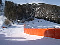
The Watles winter sports area is located on the southeast side of the mountain at an altitude of 1740 to 2500 m slm meters. Two detachable 4- seater chairlifts and a ski lift take you up to the mountain station. On the journey from the valley station at 1750 meters to the mountain station at the Plantapatsch hut at 2150 meters, the cable car overcomes a difference in altitude of 400 meters.
The Watles ski area is a member of the Ortler Skiarena and the Zwei Länder Skiarena .
Valley run in the Watles ski area

View from the Plantapatschhütte

