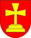
Wepryk (Hajaj)
| Wepryk | ||

|
|
|
| Basic data | ||
|---|---|---|
| Oblast : | Poltava Oblast | |
| Rajon : | Hadjach Raion | |
| Height : | 115 m | |
| Area : | 84.921 km² | |
| Residents : | 2,915 (2004) | |
| Population density : | 34 inhabitants per km² | |
| Postcodes : | 37362 | |
| Area code : | +380 5354 | |
| Geographic location : | 50 ° 22 ' N , 34 ° 11' E | |
| KOATUU : | 5320482001 | |
| Administrative structure : | 1 village | |
| Address: | вул. Васюти 71 37 362 с. Веприк |
|
| Statistical information | ||
|
|
||
Wepryk ( Ukrainian and Russian Веприк ) is a village in the north of the Ukrainian Poltava Oblast with about 2900 inhabitants (2004).
The village, which was founded in the first quarter of the 17th century, is the only settlement of the district council of the same name in Hadjach Rajon .
Wepryk located on the left bank of the Psel opposite the village Knyschiwka ( Книшівка ) 15 km to the east of Rajonzentrum Hadiach and 113 km northwest of the Oblastzentrum Poltava . Through the village leading territorial road T-17-05 .
During the Great Northern War , the village, which at that time was developed into a Cossack fortress, was besieged by the Swedish army from December 24th, 1708 to January 7th, 1709 and finally stormed . On January 9, 1709, the village was on the direct order of the Swedish King Charles XII. burned down and the fortress razed.
Web links
Individual evidence
- ↑ The village's website on the Verkhovna Rada website , accessed on April 30, 2015


