West Florida
West Florida ( English West Florida , Spanish Florida Occidental ) was the name of the coast of the Gulf of Mexico between the mouth of the Mississippi and today's US state of Florida , the historic East Florida .
history
From 1682 to 1763 the area was part of the French colony of Louisiana . After the Seven Years' War it became part of Great Britain , which organized it as a colony of West Florida. Pensacola became the capital . The northern border of the colony was initially the 31st parallel, in 1767 it was moved to 32 ° 28 '.
In the American War of Independence , in which Spain participated as an ally of France on the side of the insurgent colonists, both remained loyal to Florida. After the war, they were ceded to Spain in the Peace of Paris without defining the northern border. Spain claimed the first northerly, 1767 set limit, accepted in 1795 with the United States closed Pinckney's Treaty , however, the 31 latitude.
In 1810 there was a rebellion of American settlers in West Florida against Spanish rule. A free and independent republic of West Florida was proclaimed, the constitution of which was closely based on the US constitution. On October 27, 1810 , West Florida was annexed by the USA , which saw the area as part of the Louisiana colony acquired by France in the Louisiana Purchase in 1803 . In the Adams-Onís Treaty of 1819, Spain ceded all of its areas in Florida to the United States.
The area of western Florida was divided between the present-day US states Louisiana , Mississippi , Alabama and Florida.
additional
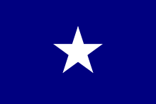
The rebels who revolted against Spanish rule in 1810 used a forerunner of the Bonnie Blue Flag , which was used by the rebels in the Civil War 50 years later .


