White Oak (Maryland)
| White Oak, Maryland | |
|---|---|
 |
|
| Location in Maryland | |
| Basic data | |
| State : | United States |
| State : | Maryland |
| County : | Montgomery County |
| Coordinates : | 39 ° 3 ′ N , 76 ° 59 ′ W |
| Time zone : | Eastern ( UTC − 5 / −4 ) |
| Residents : | 20,973 (as of: 2000) |
| Population density : | 1,625.8 inhabitants per km 2 |
| Area : | 12.9 km 2 (approx. 5 mi 2 ) of which 12.9 km 2 (approx. 5 mi 2 ) are land |
| Height : | 113 m |
| FIPS : | 24-84375 |
| GNIS ID : | 0591544 |
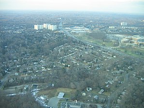
White Oak is a town in Montgomery County in the US state of Maryland . White Oak is not a closed locality, but exists as a unit summarized for statistical purposes, a so-called census-designated place (CDP). Many White Oak residents consider themselves residents of the neighboring community of Silver Spring .
White Oak is known as the site of the former Naval Ordnance Laboratory , which was operated by the United States Navy until 1994. The site is used by the US Federal Food and Drug Administration (FDA) (as of 2013).
Web links
Commons : White Oak (Maryland) - Collection of images, videos, and audio files
Individual evidence
- ^ Census 2000 Gazetteer Files. (No longer available online.) United States Census Bureau, archived from the original on September 24, 2015 ; Retrieved July 1, 2013 . Info: The archive link was inserted automatically and has not yet been checked. Please check the original and archive link according to the instructions and then remove this notice.
