Wilhelmshöhe (Huerth)
| Wilhelmshöhe | ||
|---|---|---|
|
Wilhelmshöhe |
||
| height | 154.8 m above sea level NHN | |
| location | near Huerth ; Rhein-Erft-Kreis , North Rhine-Westphalia ( Germany ) | |
| Mountains | Ville | |
| Coordinates | 50 ° 52 '53 " N , 6 ° 47' 26" E | |
|
|
||
| Type | Recultivated waste dump | |
| particularities | Highest point in Hürth | |
The Wilhelmshöhe in Hürth is an overburden dump on the edge of the Berrenrather Börde in the Ville between Hürth, Kerpen and Frechen . At almost 155 meters, it is the highest elevation in Hürth and was created as a dump for open- cast lignite mining in the surrounding areas.
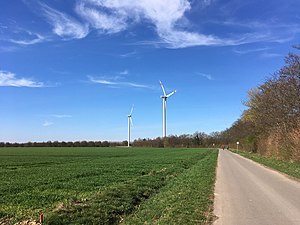
The city of Hürth planned a wind farm on Wilhelmshöhe, which initially threatened to fail due to the contradiction in airspace security . At the end of 2015, however, the Bremen-based company Energiekontor was able to start building three wind turbines, each with an output of 2.85 MW and a total height of 150 m . The completion took place in 2016. The standard energy capacity of the wind farm is around 16 million kWh per year.
Web links
- Wilhelmshöhe at geoview.info
Individual evidence
- ↑ Information according to the digital terrain model (available in the TIM-online map service )
- ↑ Flat paths on a high ledge
- ↑ Air traffic control complains against wind turbines in Hürth
- ↑ Wind energy performance Energiekontor ( page no longer available , search in web archives ) Info: The link was automatically marked as defective. Please check the link according to the instructions and then remove this notice. As of 2017.
- ↑ Energy transition Three wind turbines are growing up in Hürth

