Wings
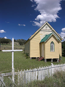
Community Hall of Wingen
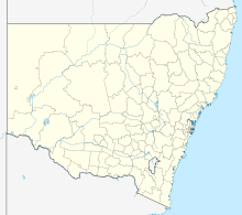
Wingen is a village in Upper Hunter Shire , New South Wales , Australia . The village is on the New England Highway and has several hundred residents.
Wingen has long been known for its Burning Mountain coal brandy . The Burning Mountain burns, according to scientific estimates for 6000 years, making it the oldest known natural fire in a coal seam . The name of the place probably goes back to the seam fire; in the language of the regional Aboriginal tribe , the Wonnarua , the word means "fire".
Web links Individual evidence
↑ Australian Bureau of Statistics : Wingen English ) In: 2016 Census QuickStats . June 27, 2017. Retrieved February 8, 2020.
↑ actually: Mount Wingen
^ Joseph Lauterer : Topography of Australia . In: Australia and Tasmania. Herder, Freiburg im Breisgau 1900, p. 416http: //vorlage_digitalisat.test/1%3D~GB%3DkEHyAgAAQBAJ~IA%3D~MDZ%3D%0A~SZ%3DPA416~ double-sided%3D~LT%3D%27%27Topographie%20Australiens%27%27.%20In % 3A% 20% 27% 27Australia% 20and% 20Tasmania.% 27% 27% 20Herder% 2C% 20Freiburg% 20im% 20Breisgau% 201900% 2C% 20S.% 20416 ~ PUR% 3D
↑ Kevin Krajick : Fire in the Hole. Raging in mines from Pennsylvania to China, coal fires threaten towns, poison air and water, and add to global warming. Smithsonian Institution ) May 2005, pp. 54ff., Accessed December 13, 2015.
^ Burning Mountain Sydney Morning Herald , February 8, 2004; accessed December 13, 2015.
<img src="https://de.wikipedia.org//de.wikipedia.org/wiki/Special:CentralAutoLogin/start?type=1x1" alt="" title="" width="1" height="1" style="border: none; position: absolute;">


