Wuhrsteinalm
| Wuhrsteinalm | ||
|---|---|---|
|
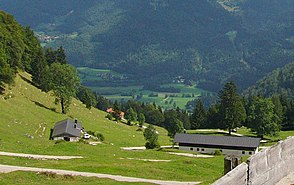
Weitlechnerkaser (right) and Grafenkaser (left) of the Wuhrsteinalm |
||
| location | Bavaria , Germany | |
| Mountains | Chiemgau Alps | |
| Geographical location | 47 ° 42 '2 " N , 12 ° 21' 3" E | |
|
|
||
| height | 1145 m above sea level NHN | |
The Wuhrsteinalm is an alpine pasture in the Schlechinger Forest in the Schleching municipality .
Three barns on the Wuhrsteinalm are under monument protection and are entered in the Bavarian monument list under the numbers D-1-89-141-70, D-1-89-141-71 and D-1-89-141-72 .
location
The Wuhrsteinalm is located southeast of the Geigelstein in the Chiemgau Alps at an altitude of 1145 m above sea level. NHN in the immediate vicinity of the mountain station of the Geigelsteinbahn.
Building description
The Huberkaser (file number D-1-89-141-70) is a stone building with a flat saddle roof , the building is marked with the year 1853. The address is "Wuhrstein 20".
The Grafenkaser (file number D-1-89-141-71) is also a stone building with a flat gable roof, the building is marked with the year 1857. The address is "Wuhrstein 12".
The Weitlechnerkaser (file number D-1-89-141-72) is also a stone building with a flat gable roof, the building is marked with the year 1857. The address is "Wuhrstein 13".
Todays use
The Wuhrsteinalm is used for agriculture; But there is also an inn here, which is run as a contract house of the German Alpine Club (managed hut). It is open from April to the end of December, also offers overnight stays and day trippers are catered for from Wednesday to Sunday.
Web links
- Internet presence wuhrsteinalm.de
- Wuhrsteinalm . In: Agricultural and cultural heritage database . Society for Agricultural History

