Yate (volcano)
| Yate (volcano) | ||
|---|---|---|
|
Yate from Huar island in the Gulf of Ancud |
||
| height | 2187 m | |
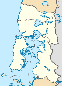
| location | Llanquihue Province , Chile | |
| Mountains | To the | |
| Coordinates | 41 ° 45 ′ 18 ″ S , 72 ° 23 ′ 46 ″ W | |
|
|
||
| Type | Stratovolcano | |
The Yate is a 2187 meter high volcano in the Andes in southern Chile . It is located in the 48,232 hectare Hornopiren National Park of the Hualaihué region and belongs to the Liquiñe Ofqui Trench .
Landslide in 1965
On February 19, 1965, six to ten million cubic meters of ice and rock loosened and slid 7.5 kilometers down into Lago Caprera . At the western end of the lake, a tsunami wave of more than 25 meters formed, which destroyed a settlement and claimed 27 lives. Researchers assume that such an event repeats about every 100 years and that global warming will intensify it.
Web links
Commons : Yate - collection of pictures, videos and audio files
- Yate (Vulkan) in the Global Volcanism Program of the Smithsonian Institution (English)
- 2 days - lakes and volcanoes ( Memento from October 17, 2014 in the Internet Archive ), Latinotours.de (accessed on May 11, 2011)
- Yate Volcano , Volcanolive.com (Accessed May 11, 2011)
- Yate Vulkan site map , Mineralienatlas.de (accessed on May 11, 2011)

