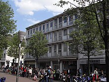
Zehnthofstrasse (Düren)
The Zehnthofstraße in the district town Düren ( Nordrhein-Westfalen ) is an ancient city road .
The street connects Kaiserplatz with Schenkelstraße . Zehnthofstraße is closed to through traffic and may only be used by buses, taxis and delivery traffic (at certain times). Along with Wirtelstrasse, which runs parallel to it, it is one of the main shopping streets in the city center. Zehnthofstraße is directly connected to Wirtelstraße by the pedestrian zone of Kleine Zehnthofstraße .
history
Already in the year 888 the Aachen Marienstift received its tenth in Düren. The Zehnthof was within the Düren city fortifications at the western end of today's Zehnthofstrasse. The location at that time was already marked in Wenceslaus Hollar's city map from 1634. The street ran from the cattle market to the Wirteltor . After the secularization , Adam Mohren became the owner of the farm, and his descendants managed the estate for generations. The street ended as a dead end at the city wall, which ran roughly parallel to Schenkelstraße. Only on June 10, 1864, when the city wall was demolished , it was possible to pass through to Schenkelstrasse, which ran at right angles. The street section was then called Mohrenstrasse , named after the tenant of the Zehnthof, which was demolished in 1865. Mohrenstrasse and Zehnthofstrasse were jointly renamed Zehnthofstrasse by the decision of the city council on December 6, 1898. On April 21, 1891, the new building of the Stiftisches Gymnasium was inaugurated in the street . It was completely destroyed in the air raid on November 16, 1944 .
From 1908 to 1944 the tram of the Dürener Kreisbahn (DKB) ran on Zehnthofstrasse. The double-track line led from the market to the train station, but there was no stop on Zehnthofstrasse. The line was not rebuilt after the war.
Today, on the corner of Zehnthofstrasse and Schenkelstrasse, the former location of the Stiftisches Gymnasium, the large building of the Sparkasse Düren stands . At the other end of the street on the corner of Kaiserplatz is the town hall . The residential and commercial building at Zehnthofstrasse 26–32 is a listed building .
See also
swell
- List of streets on the website of the city of Düren (PDF; 58 kB)
- Josef Geuenich: The Düren street names , Düren 1965, published by the city of Düren and the Düren history association
Individual evidence
- ^ Dürener Kreisbahn GmbH (ed.): 75 years of Dürener Kreisbahn ; Düren, 1983, p. 14
Coordinates: 50 ° 48 ′ 12.6 " N , 6 ° 28 ′ 57.7" E

