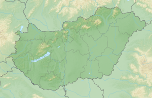
Zengő
| Zengő | ||
|---|---|---|
| height | 682 m | |
| location | Baranya County , Hungary | |
| Mountains | Mecsek Mountains | |
| Coordinates | 46 ° 11 ′ 0 ″ N , 18 ° 23 ′ 0 ″ E | |
|
|
||
The Zengő [ ˈzɛŋɡøː ] is at 682 m the highest mountain in the southern Hungarian Mecsek Mountains . It is continuously overgrown with deciduous forest, only in very few cool and shady places there is a little - somewhat ailing - coniferous forest .
Some time ago, a large-scale environmental protection campaign to protect the Zengő was running because the Hungarian government wants to build a radar system on the Mecsek for military surveillance of the airspace , even though the mountain is under nature protection. However, these plans were abandoned in 2011.
The Zengő can be reached via hiking trails from Hosszúhetény , Püspökszentlászló , Kisújbánya and Pécsvárad .
