Second Kuril Road
| Second Kuril Road | ||
|---|---|---|
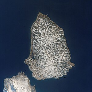
| Satellite image. From left to right: Paramushir, Second Kuril Street, Shumshu, Kuril Street , Cape Lopatka . | ||
| Connects waters | Sea of Okhotsk | |
| with water | Pacific Ocean | |
| Separates land mass | Shumshu | |
| of land mass | Paramushir | |
| Data | ||
| Geographical location | 50 ° 43 '0 " N , 156 ° 10' 0" E | |
|
|
||
| Smallest width | 1.8 km | |
| Greatest depth | 10 m | |
| Coastal towns | Severo-Kurilsk | |
| Map of the northern Kuril Islands with Russian names: The Second Kuril Road is located in the northeast between the islands of Paramushir and Shumschu | ||
The Second Kuril Road ( Russian Второй курильский пролив ; Wtoroi kurilski proliw ) is a narrow strait in the northern Kuril Islands . It separates the two islands of Paramushir and Shumshu . Its width is only 1.8 km. It connects the Sea of Okhotsk with the Pacific Ocean .


