San Cayetano, Norte de Santander: Difference between revisions
Content deleted Content added
m Removing from Category:Populated places in the Norte de Santander Department in subcat using Cat-a-lot |
m →top |
||
| Line 6: | Line 6: | ||
|motto = |
|motto = |
||
|settlement_type = [[Municipalities of Colombia|Municipality]] and town |
|settlement_type = [[Municipalities of Colombia|Municipality]] and town |
||
|image_skyline = |
|image_skyline = Sancayetano NS jul 2023.jpg |
||
|imagesize = |
|imagesize = |
||
|image_caption = |
|image_caption = |
||
Revision as of 00:49, 5 July 2023
You can help expand this article with text translated from the corresponding article in Spanish. (January 2017) Click [show] for important translation instructions.
|
San Cayetano | |
|---|---|
Municipality and town | |
 | |
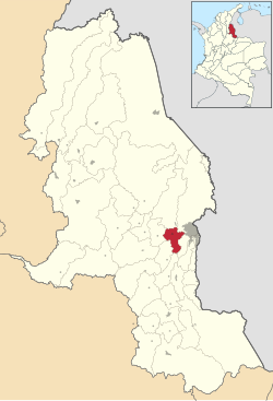
 Location of the municipality and town of San Cayetano, Norte de Santander in the Norte de Santander Department of Colombia. | |
| Country | |
| Department | Norte de Santander Department |
| Area | |
| • Municipality and town | 144 km2 (56 sq mi) |
| Elevation | 235 m (771 ft) |
| Population (2015) | |
| • Municipality and town | 5,424 |
| • Density | 38/km2 (98/sq mi) |
| • Urban | 2,092 |
| Time zone | UTC-5 (Colombia Standard Time) |
San Cayetano is a municipality and town in the Norte de Santander Department in Colombia. Part of its area pertains to the Metropolitan Area of Cúcuta.[1]
References
- ^ Saul Bernard Cohen (2008). The Columbia Gazetteer of the World: P to Z. Columbia University Press. pp. 3367–. ISBN 978-0-231-14554-1.
External links
7°52′49″N 72°37′40″W / 7.88028°N 72.6278°W


