
Burke County, North Dakota: Difference between revisions
No edit summary |
|||
| Line 93: | Line 93: | ||
The median income for a household in the county was $25,330, and the median income for a family was $31,384. Males had a median income of $28,164 versus $16,382 for females. The [[per capita income]] for the county was $14,026. About 11.70% of families and 15.40% of the population were below the [[poverty line]], including 17.20% of those under age 18 and 16.50% of those age 65 or over. |
The median income for a household in the county was $25,330, and the median income for a family was $31,384. Males had a median income of $28,164 versus $16,382 for females. The [[per capita income]] for the county was $14,026. About 11.70% of families and 15.40% of the population were below the [[poverty line]], including 17.20% of those under age 18 and 16.50% of those age 65 or over. |
||
==Economy== |
|||
Farming and oil. Burke County is one of several western North Dakota counties with significant exposure to the [[Bakken_Formation]] in the [[Williston Basin]]. |
|||
==Communities== |
==Communities== |
||
Revision as of 14:32, 29 August 2008
Burke County | |
|---|---|
 Location within the U.S. state of North Dakota | |
 North Dakota's location within the U.S. | |
| Coordinates: 48°47′N 102°31′W / 48.79°N 102.52°W | |
| Country | |
| State | |
| Founded | 1910 |
| Seat | Bowbells |
| Largest city | Bowbells |
| Area | |
| • Total | 1,129 sq mi (2,920 km2) |
| • Land | 1,104 sq mi (2,860 km2) |
| • Water | 26 sq mi (70 km2) 2.28% |
| Population (2000) | |
| • Total | 2,242 |
| • Density | 20/sq mi (08/km2) |
| Website | www |
Burke County is a county located in the U.S. state of North Dakota. As of 2000, the population was 2,242. Its county seat is Bowbells.Template:GR
History
Burke County was founded in 1910 and is named after John Burke (1859–1937), a politician who served as governor of North Dakota and Treasurer of the United States.
Geography
According to the U.S. Census Bureau, the county has a total area of 1,129 square miles (2,925 km²), of which, 1,104 square miles (2,858 km²) of it is land and 26 square miles (67 km²) of it (2.28%) is water.
Townships
|
|
|
Major highways
Adjacent counties and rural municipalities
- Estevan No. 5, Saskatchewan (north)
- Coalfields No. 4, Saskatchwan (north)
- Village of North Portal, Saskatchewan (north)
- Enniskillen No. 3, Saskatchewan (north)
- Renville County (east)
- Ward County (southeast)
- Mountrail County (south)
- Williams County (southwest)
- Divide County (west)
Demographics
As of the censusTemplate:GR of 2000, there were 2,242 people, 1,013 households, and 680 families residing in the county. The population density was 2.0 people per square mile (0.8/km²). There were 1,412 housing units at an average density of 1.3 per square mile (0.5/km²). The racial makeup of the county was 99.24% White, 0.13% Black or African American, 0.22% Native American, 0.13% Asian, 0.04% from other races, and 0.22% from two or more races. 0.36% of the population were Hispanic or Latino of any race. 52.4% were of Norwegian, 18.4% German and 7.4% Swedish ancestry according to Census 2000.
There were 1,013 households out of which 23.00% had children under the age of 18 living with them, 58.20% were married couples living together, 5.30% had a female householder with no husband present, and 32.80% were non-families. 31.60% of all households were made up of individuals and 17.60% had someone living alone who was 65 years of age or older. The average household size was 2.21 and the average family size was 2.77.
In the county the population was spread out with 20.80% under the age of 18, 3.50% from 18 to 24, 22.30% from 25 to 44, 28.30% from 45 to 64, and 25.10% who were 65 years of age or older. The median age was 48 years. For every 100 females there were 101.60 males. For every 100 females age 18 and over, there were 103.80 males.
The median income for a household in the county was $25,330, and the median income for a family was $31,384. Males had a median income of $28,164 versus $16,382 for females. The per capita income for the county was $14,026. About 11.70% of families and 15.40% of the population were below the poverty line, including 17.20% of those under age 18 and 16.50% of those age 65 or over.
Economy
Farming and oil. Burke County is one of several western North Dakota counties with significant exposure to the Bakken_Formation in the Williston Basin.
Communities
Cities
Note: all incorporated communities in North Dakota are called "cities" regardless of their size.
Unincorporated communities
References
Municipalities and communities of Burke County, North Dakota, United States | ||
|---|---|---|
| Cities | 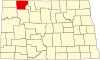 | |
| Townships | ||
| Unorganized territory | ||
| CDP | ||
| Other communities | ||
| Indian reservation | ||
| Footnotes | ‡This populated place also has portions in an adjacent county or counties | |
