
Andros, Bahamas: Difference between revisions
John.bond954 (talk | contribs) Added substantial detail to the Tourism section; removed several redundancie. |
John.bond954 (talk | contribs) Significantly expanded the section on the History of Andros; corrected several minot format errors |
||
| Line 13: | Line 13: | ||
| coordinates = {{Coord|24|26|N|77|57|W|display=inline}} |
| coordinates = {{Coord|24|26|N|77|57|W|display=inline}} |
||
| archipelago = [[The Bahamas]] |
| archipelago = [[The Bahamas]] |
||
| t otal islands = |
| t otal islands = |
||
| major islands = [[North Andros]], [[Mangrove Cay]], [[South Andros]] |
| major islands = [[North Andros]], [[Mangrove Cay]], [[South Andros]] |
||
| area_km2 = 5957 |
| area_km2 = 5957 |
||
| Line 57: | Line 57: | ||
== Climate == |
== Climate == |
||
Andros lies just north of the [[Tropic of Cancer]], with moderate temperature range affected by its relative proximity to the Gulf Stream to the west. The island has a semitropical climate with only two seasons, summer (May-November) and winter (December-April). Midsummer temperatures range from 27C-29 C/80F-85F with a relative humidity of 60 to 100 percent. Winter temperatures range from 21C-24C/70-75F and can drop to 5C/41F after dark.<ref>{{cite web|title=Geography of the Bahamas|url=http://www.photius.com/countries/bahamas_the/geography/bahamas_the_geography.html}}</ref> <ref>{{cite web|title=Bahamas Travel Guide/Weather|url=http://www.iexplore.com/dmap/Bahamas/Weather+and+Climate&nav=next;$sessionid$DGSLA2YAAAVWMP2MN5XCFEQ}}</ref> Andros Island is hit by a Bahamas hurricane an average of every 2.5 years. The Great Florida Hurricane of 1929 is known in the Bahamas as The Great Andros Hurricane. Notable strikes in the modern era have included Hurricanes Betsy (1965), David (1979), Arlene (1987), Andrew (1992), Lili (1996), Floyd (1999), Michelle (2001), and Wilma (2005)<ref>{{cite web|title=Bahamas Weather|url=http://www.bahamasweather.org.bs/index.php?page=storm-history}}</ref> |
Andros lies just north of the [[Tropic of Cancer]], with moderate temperature range affected by its relative proximity to the [[Gulf Stream]] to the west. The island has a semitropical climate with only two seasons, summer (May-November) and winter (December-April). Midsummer temperatures range from 27C-29 C/80F-85F with a relative humidity of 60 to 100 percent. Winter temperatures range from 21C-24C/70-75F and can drop to 5C/41F after dark.<ref>{{cite web|title=Geography of the Bahamas|url=http://www.photius.com/countries/bahamas_the/geography/bahamas_the_geography.html}}</ref> <ref>{{cite web|title=Bahamas Travel Guide/Weather|url=http://www.iexplore.com/dmap/Bahamas/Weather+and+Climate&nav=next;$sessionid$DGSLA2YAAAVWMP2MN5XCFEQ}}</ref> Andros Island is hit by a Bahamas hurricane an average of every 2.5 years. The Great Florida Hurricane of 1929 is known in the Bahamas as The Great Andros Hurricane. Notable strikes in the modern era have included Hurricanes Betsy (1965), David (1979), Arlene (1987), Andrew (1992), Lili (1996), Floyd (1999), Michelle (2001), and Wilma (2005)<ref>{{cite web|title=Bahamas Weather|url=http://www.bahamasweather.org.bs/index.php?page=storm-history}}</ref> |
||
== Economy == |
== Economy == |
||
| Line 77: | Line 77: | ||
Andros is home to a number of festivals: Crabfest at Fresh Creek each June , the annual regatta at Morgan’s Bluff , Conch Festival, a local Junkanoo and Goombay festival between Christmas and New Year’s, the Pirate’s Festival and the Annual Seafood Splash & Chickcharnie Festival. In addition ANCAT sponsors numerous ecologically oriented events for tourists and locals. |
Andros is home to a number of festivals: Crabfest at Fresh Creek each June , the annual regatta at Morgan’s Bluff , Conch Festival, a local Junkanoo and Goombay festival between Christmas and New Year’s, the Pirate’s Festival and the Annual Seafood Splash & Chickcharnie Festival. In addition ANCAT sponsors numerous ecologically oriented events for tourists and locals. |
||
| ⚫ | |||
The first inhabitants of Andros Island were probably the indigenous [[Lucayan]] people. The [[Lucayans]] throughout the Bahamas were wiped out mainly by exposure to disease following the arrival of the [[Spain|Spanish]] in the 1550s |
|||
During the 18th century [[pirate]]s occupied the island. Morgan's Bluff and Morgan's Cave on North Andros are named after the famous privateer-pirate, [[Henry Morgan]]. [[Loyalist (American Revolution)|Loyalists]] and their slaves also settled in Andros in the late 18th century. |
|||
Andros Island's port of Fresh Creek was once a popular hangout for the "[[Rat Pack]]," including [[Sammy Davis, Jr.]]. |
|||
| ⚫ | In the 1960s and 1970s the Owens Lumber company, a US-owned company, [[Deforestation|deforested]] much of the indigenous [[Bahamian pineyards|pineyards]] that grew on North Andros. As a result of poor planning for re-growth, what is found on the island today are over-crowded forests of mainly young trees. |
||
Owing to its proximity to the [[Tongue of the Ocean]] and network of [[Freshwater|fresh]] and [[Seawater|saltwater]] [[blue hole]]s, Andros Island became a popular [[scuba diving]] destination in the early days of the sport, frequented by such well known divers as [[Jacques Cousteau]]. The first dive resort was built by Dick Birch of Canada. A second resort opened by Archie Forfar, a Canadian native who later died trying to break the Guinness world record for deep diving. His resort, in Blanket Sound, is now home to [[For Far Field Station, Bahamas|Forfar Field Station]], an environmental education facility owned and operated by International Field Studies. |
|||
| ⚫ | |||
The Spanish named the island “Espiritu Santo,” the Island of the Holy Spirit. A 1782 map calls it San Andreas.{{Citation needed|date=January 2010}} The modern name is believed to be in honour of Sir [[Edmund Andros]], Commander of Her Majesty’s Forces in [[Barbados]] in 1672 and governor successively of New York, New England, and Virginia.{{Citation needed|date=January 2010}} However, the island could have been named after the inhabitants of ''St Andro Island'' ([[San Andrés and Providencia Department|St Andrew or San Andrés]]) on the [[Mosquito Coast]], since 1,400 of them settled in Andros in 1787.{{Citation needed|date=January 2010}} A less likely theory suggests that the island was name after the Greek isle of [[Andros]] by Greek sponge fishermen.<ref>{{cite book |first=Jennifer |last=McMorran |title=The Islands of the Bahamas |page=271 }}</ref> |
|||
== Flora and Fauna == |
== Flora and Fauna == |
||
“As the largest island in the Bahamas, Andros exhibits greater botanical diversity than any other island. The presence of Andros’ barrier reef and the Tongue of the Ocean give the island a great zoological diversity.”<ref>{{cite book|last=Randolph, Ph.D.|first=Logan|title=An Ethnobotanical Investigation of Andros, Island, Bahamas,|year=1994|pages=3-4}}</ref> Among the various land eco-systems are hardwood coppice, pineyard, scrub, saltwater marsh, rocky and sandy beaches, palm savannas and mangroves. Non-coastal areas on Andros are referred to generically as ‘the bush.’ Coastal mangrove flats and estuaries are referred to as ‘the swash,’ or salt water marsh. |
“As the largest island in the Bahamas, Andros exhibits greater botanical diversity than any other island. The presence of Andros’ barrier reef and the Tongue of the Ocean give the island a great zoological diversity.”<ref>{{cite book|last=Randolph, Ph.D.|first=Logan|title=An Ethnobotanical Investigation of Andros, Island, Bahamas,|year=1994|pages=3-4}}</ref> Among the various land eco-systems are hardwood coppice, pineyard, scrub, saltwater marsh, rocky and sandy beaches, palm savannas and mangroves. Non-coastal areas on Andros are referred to generically as ‘the bush.’ Coastal mangrove flats and estuaries are referred to as ‘the swash,’ or salt water marsh. |
||
| Line 111: | Line 98: | ||
The island's [[blue hole]]s are water filled [[cave]] systems. They attract [[Cave diving|cave divers]] from all over the world to dive sites such as 'Stargate', 'The Guardian' and 'Little Frenchman'. There are blue holes in the ocean and inland. Two of the inland blue holes on Andros include Charlie's Blue Hole, reputedly first explored by [[Jacques-Yves Cousteau]], and the larger Church's Blue Hole and Guardian Blue Hole.<ref>Rob Palmer, ''Deep into Blue Holes''. Unwin Hyman Limited, 1989. ISBN 0-04-440380-1.</ref> |
The island's [[blue hole]]s are water filled [[cave]] systems. They attract [[Cave diving|cave divers]] from all over the world to dive sites such as 'Stargate', 'The Guardian' and 'Little Frenchman'. There are blue holes in the ocean and inland. Two of the inland blue holes on Andros include Charlie's Blue Hole, reputedly first explored by [[Jacques-Yves Cousteau]], and the larger Church's Blue Hole and Guardian Blue Hole.<ref>Rob Palmer, ''Deep into Blue Holes''. Unwin Hyman Limited, 1989. ISBN 0-04-440380-1.</ref> |
||
| ⚫ | |||
=== PRE-COLUMBIAN & SPANISH ERAS === |
|||
Artifacts and remains of [[Lucayans]], a subgroup of the [[Taino]] people indigenous to the Bahamas at the time of European discovery have been found in both Morgan’s Cave on North Andros, and in the Stargate Blue Hole on South Andros.<ref>{{cite web|title=First Ever Lucayan Canoe Found in Bahamas|url=http://www.blueholes.org/The%20Rob%20Palmer%20Blue%20Holes%20Foundation/Archeological%20finds.html|publisher=The Roue Holes Foundationb Palmer Bl}}</ref> |
|||
The population of the Bahamas is estimated to have been approximately 40,000 Lucayan-Tainos at the time of the arrival of the Spanish. Prized for their free-diving capabilities used in fishing conch, they were enslaved by the Spanish and mostly sent to Cubagua as pearl divers. An expedition by the Spanish in 1520 to round up all remaining Lucayans discovered only 11 people—the Lucayans were effectively extinct. After the extermination of the Lucayans, there were no known permanent settlements in the Bahamas—including Andros Island—for approximately 130 years. |
|||
Spain laid claim to the Bahamas including Andros Island after Columbus’ discovery of the islands—his first landfall in the Western Hemisphere was on the Bahamian island of San Salvador. The Italian explorer [[Amerigo Vespucci]], for whom the Americas are named, on a Spanish charter spent four months exploring the Bahamas in 1499-1500, and mapped a portion of the eastern shore of Andros Island. [[Ponce de Leon]] sailed by Andros on his journey from Cuba to Florida in search of the Fountain of Youth in 1513. |
|||
The Bahamas passed back and forth from ownership by Spain and Great Britain for 150 years, with final ownership by Britain established by treaty in 1783, when Great Britain exchanged East Florida to Spain, receiving the Bahamas in return. |
|||
=== BRITISH COLONIAL ERA 1648-1973 === |
|||
In 1648 British settlers from Bermuda established a colony on Eleuthera and in 1666 Charles Town—later renamed Nassau—was founded on New Providence. In 1787 the Bahamas became a British colony. Self-rule was granted in 1964 and independence in 1973. |
|||
During the late 1600s and 1700s various pirates and buccaneers frequented Andros Island. In 1713 the Bahama Islands were declared a Pirate’s Republic. Morgan's Bluff and Morgan's Cave on North Andros are named after the famous privateer-pirate, [[Henry Morgan]], for whom [[Captain Morgan’s Spiced Rum]] is named. It is said that the Andros settlement of Small Hope Bay was so named because Morgan claimed there would be “small hope” of anybody finding the treasure he had hidden there. Pirates raiding the Spanish treasure galleons out of Cuba maintained a settlement on South Andros. |
|||
[[Loyalists]] fleeing Mainland America after the American Revolution settled on various Bahama Islands including Andros, bringing their slaves with them. By 1788 the islands of New Providence, Abaco, Exuma, Eleuthera, Harbour Island, Long Island, Cat Island, Turks Island and Andros were inhabited by a reported population of three thousand whites and 8000 blacks. The 1788 census reported 22 white heads of families with 132 slaves on Andros, cultivating 813 acres of land.<ref>{{cite book|last=Riley|title=Homeward Bound|pages=180, 185}}</ref> |
|||
In 1821 Seminoles and black slaves fleeing Florida were brought to the west coast of Andros by the wrecking vessel ‘Steerwater,’ where they established the settlement of Red Bays.<ref>{{cite book|last=Randolph, Ph.D.|first=Logan|title=An Ethnobotanical Investigation|year=1994|pages=5}}</ref> Additional [[Black Seminoles]] traveling by canoe across the Gulf Stream joined them over the next several decades.<ref>{{cite book|last=Howard|first=Rosalyn|title=Black Seminoles in the Bahamas|year=2002|publisher=University Press of Florida}}</ref> |
|||
After the British Empire ended slavery of blacks with emancipation in 1834, African immigration to the Bahamas continued through the raiding of passing slave ships by Bahamian mariners. Slaves freed in this manner entered a system of apprenticeship or indentured servitude. Many of these freed Africans and their offspring immigrated to the Out Islands including Andros, resulting in an indigenous culture that is closer to African than most other black cultures in the Western Hemisphere.<ref>{{cite book|last=Randolph, Ph.D|first=Logan|title=An ethonbotanical Investigation|pages=13, 15}}</ref> |
|||
In the 19th and early 20th centuries (1841-1938) Greek spongers immigrated to Andros for the rich sponge fishing on the Great Bahama Bank off Andros’ west coast. For a period of years Andros sponging was the Bahamas’ largest industry. The sponges were wiped out by [[Red Tide]] algae in the 1930s, and the sponging industry died and the spongers left the island for [[Key West]],and [[Tarpon Springs]], Florida, and thousands of unemployed Bahamians moved to the village of [[Coconut Grove]] near Miami.<ref>{{cite book|last=Craton & Saunders|first=Michael & Gail|title=Islanders in the Stream|pages=144-152}}</ref> |
|||
| ⚫ | In the 1950s, 1960s and 1970s the Owens Lumber company, a US-owned company, [[Deforestation|deforested]] much of the indigenous [[Bahamian pineyards|pineyards]] that grew on North Andros. As a result of poor planning for re-growth, what is found on the island today are over-crowded forests of mainly young trees. |
||
In the 1960s and 1970s the Bahamas led by [[Sir Lyndon Pindling]], the Member of Parliament for Kemps Bay on South Andros, negotiated independence from the British. Self-rule was granted in 1964 and one-man one-vote Majority Rule in 1967. The Bahamas achieved Independence July 10, 1973. One of the final acts of the British rulership of the Bahamas was to grant AUTEC a long-term lease for land on Andros, not unlike the lease of Guantanamo Bay in Cuba. Pindling became the first Prime Minister of the Bahamas, and served until 1992, when his party lost control of Parliament, but he retained his seat representing South Andros. |
|||
| ⚫ | |||
Originally named Espiritu Santu by the Spanish, Andros Island took its present name sometime early during the period of British colonial dominion over the Bahamas. Several eighteenth century British documents refer to it as Andrews Island.<ref>{{cite book|last=Riley|first=Sandra|title=Homeward Bound, A History of the Bahamas to 1850|year=1989|publisher=Island Research Press|pages=38, 50}}</ref> A 1782 map refers to the island as San Andreas.[citation needed] The modern name is believed to be in honor of Sir [[Edmund Andros]], Commander of Her Majesty’s Forces in Barbados in 1672 and governor successively of New York, Massachusetts, and New England.[citation needed] |
|||
Secondary and tertiary sources indicate that the island may have been named after the inhabitants of St Andro Island ([[St Andrew or San Andrés]]) off the [[Mosquito Coast]] of Honduras, because 1,400 of them reportedly settled in Andros in 1787.[citation needed] However contemporary records indicate that the number of inhabitants of Andros in that period was many fewer than 1,400, and the original source of this report remains obscure. |
|||
Another theory suggests that the island was named after the Greek isle of [[Andros]], by Greek sponge fishermen,<ref>{{cite book|last=McMorran|first=Jennifer|title=ThIslands of the Bahamas|publisher=e|pages=271}}</ref> however this is unlikely as Greek spongers did not arrive on Andros until the mid-19th century.<ref>{{cite book|last=Craton & Saunders|first=Michael & Gail|title=Islanders in the Stream, A History of the Bahamian People from the end of Slavery to the Twenty-First Century|year=1998|publisher=University of Georgia Press|pages=148}}</ref> |
|||
The theory that the island was named for Sir Edmund Andros remains the most widely accepted. |
|||
=== SIGNIFICANT DATES IN HISTORY OF ANDROS ISLAND === |
|||
1520+/- Lucayans exterminated by Spanish |
|||
1650—1750+/- Pirate Era |
|||
1725 British naturalist [[Mark Catesby]] visits Andros<ref>{{cite book|last=Riley|title=Homeward Bound|pages=80}}</ref> |
|||
1783 British Loyalist settlers arrive |
|||
1821-1840 Black Seminoles emigrate from Florida |
|||
1841 Commercial sponging era begins in the flats of west Andros |
|||
1892 Andros Fibre (sisal plantation) founded |
|||
1938 Red Tide wipes out sponge industry |
|||
1950-1975 Deforestation of North Andros Pineyards |
|||
1960 Small Hope Bay Lodge, Bahamas’ first dive resort, opens near Fresh Creek |
|||
1964 Construction of AUTEC Base begins |
|||
1965 The U.S. submersible DSV Alvin begins career off Andros<ref>{{cite web|title=History of DSV Alvin|url=http://www.whoi.edu/page.do?pid=10737|publisher=Woods Hole Institute}}</ref> |
|||
1968 Bridges built across Fresh Creek and Stafford Creek, unifying North Andros |
|||
1970 Jacques-Yves Cousteau with his research vessel [[RV Calypso]] explores Blue Holes and Tongue of the Ocean. |
|||
1972 Androsia Batik Factory opens |
|||
1972 International Field Studies at Forfar Field Station opens |
|||
1973 Lyndon Pyndling, Member of Parliament for Kemps Bay on South Andros, becomes first Prime Minister of independent Bahamas<ref>{{cite web|title=Elections in the Bahamas|url=http://en.wikipedia.org/wiki/Elections_in_the_Bahamas|publisher=Wikipedia}}</ref> |
|||
1974 Bahamas Agricultural Research, Training and Development project initiated, fostering agriculture on Andros |
|||
1983 Mennonite Farm established near Blanket Sound |
|||
1984 [[Queen Elizabeth II]] visits Andros to dedicate Queen’s Park |
|||
1997 Andros Conservancy and Trust (ANCAT), dedicated to the ecological preservation of Andros, founded |
|||
2002 Creation of first National Parks and Marine Protected Areas on Andros |
|||
=== Famous Visitors to Andros === |
|||
Besides the pirate Morgan, Jacques Cousteau and Queen Elizabeth II, Andros has seen other famous visitors. [[Neville Chamberlain]], who later became British Prime Minister famous for declaring “Peace in our Time” after meeting with Adolph Hitler at Munich, managed a sisal plantation near Mastic Point on North Andros in the late 19th century. [[The Lighthouse Club]] at the port of Fresh Creek was a popular hangout for the "Rat Pack," including [[Sammy Davis, Jr]]. 41st U.S. President [[George Herbert Walker Bush]] and baseball great [[Ted Williams]] frequented South Andros for its bonefishing. Canadian Prime Minister [[Pierre Trudeau]] and U.S. Secretary of State [[William Rogers]] were regular visitors to Small Hope Bay Lodge for SCUBA diving, where National Geographic’s premiere underwater photographer, [[David Doubilet]], began his career working as a divemaster/guide in the 1960s.<ref>{{cite web|title=David Doubilet Biography|url=http://www.neticons.biz/pdf/DavidDoubilet.pdf|publisher=David Doubilet}}</ref> |
|||
== Political Organization == |
== Political Organization == |
||
Revision as of 02:04, 10 August 2011
Nickname: Big Yard | |
|---|---|
 | |
| Geography | |
| Location | Atlantic Ocean |
| Coordinates | 24°26′N 77°57′W / 24.433°N 77.950°W |
| Archipelago | The Bahamas |
| Area | 5,957 km2 (2,300 sq mi) |
| Length | 167 km (103.8 mi) |
| Width | 64 km (39.8 mi) |
| Administration | |
| Demographics | |
| Population | 7,800 |
| Pop. density | 1.31/km2 (3.39/sq mi) |
Andros Island is an archipelago within the archipelago-nation of the Bahamas, the largest of the 26 inhabited Bahamian Islands. Geo-politically considered a single island, Andros has an area greater than all the other 700 Bahamian islands combined. The land area of Andros consists of hundreds of small islets and cays connected by mangrove estuaries and tidal swamp lands, together with three major islands—North Andros, Mangrove Cay, and South Andros. The three main islands are separated by “bights,” estuaries which trifurcate the island, connecting the island’s east and west coasts. It is 104 miles (167 km) long by at its widest 40 miles (64 km) wide.
Geographically, North Andros is the sixth largest island in the West Indies, at roughly 6,000 km2 (2,300 sq mi) in area and 167 km (104 mi) long and 64 km (40 mi) wide at its widest point, and the 153rd largest island on Earth.[1] If all three main islands are included, Andros is the fifth largest island in the Indies, after Cuba, Hispaniola, Jamaica and Puerto Rico. Although comparable in area to the state of Rhode Island (3140 km2, population 1.05 million) and Long Island, N.Y. (3600 km2, population 7.5 million) Andros is home to a population of approximately 8000, almost all of whom are settled in a thin strip near the Queen Elizabeth Highway running along the island’s eastern coast. Outside Alaska, the Amazon Basin and northern Canada, it is one of the least densely populated places in the Western Hemisphere.
Noteworthy for a unique combination of marine features and ecosystems, Andros rests on the west side of the 6000 foot (3+ km) deep Tongue of the Ocean, The world’s third longest barrier reef after Australia’s Great Barrier Reef and the Central American Belize Barrier Reef, runs for 142 miles (225km) averaging a distance of only 1-2 miles from the Andros shore.[2] The extensive flats of the Great Bahama Bank lie to the west, northwest and south of Andros. The island is home to the world’s largest collection of Blue Holes.[3]
Thirty miles westward across the Tongue of the Ocean from the Bahamas’ national capital of Nassau on New Providence Island, Andros’ northern tip lies 138 miles/233 km from Fort Lauderdale, Florida.[4] Geologically and geographically the Bahamas, including Andros, are not located in the Caribbean Sea, whose northern boundary is the Windward Passage, but rather in the Atlantic Ocean. However, politically the nation was historically part of the British West Indies and is considered culturally to be part of the Caribbean. The Bahamian dialect of the English language is distinctively Caribbean in character, similar to those of Jamaica and the Cayman Islands, also formerly part of the British West Indies.
The township of Fresh Creek is home to the Atlantic Undersea Testing and Evaluation Center AUTEC, operated by the U.S. Navy, where the United Kingdom and the United States conduct special operations training and sonar and submarine research in the Tongue of the Ocean. AUTEC is the island’s largest single private employer. The U.S. Coast Guard also runs rescue and drug interdiction operations from AUTEC.[5]
Andros is known in the Bahamas by two nicknames, "The Sleeping Giant" and "The Big Yard."
Transportation
Andros Island has four airports with paved runways: San Andros Airport at Nicholls Town, Andros Town International Airport located at Fresh Creek, the Clarence A. Bain Airport at Mangrove Cay and Congo Town Airport in South Andros. Andros Town International is an international port of entry for private pilots. The island is served by multiple daily flights from Nassau by BahamasAir, Western Air, and LeAir—the flight to any of the four airports is 15-25 minutes. Daily scheduled flights to Nassau from London, Paris, New York City, Boston, Atlanta, Philadelphia, Houston, Dallas, Jacksonville, Miami, Fort Lauderdale, Palm Beach, Orlando and other major cities provide easy connection from Andros to the rest of the world. Regularly scheduled charters provide direct service to Andros Town from Miami and Fort Lauderdale, Florida, mostly offered by Gulfstream International Airlines. Continental Connection offers seasonal scheduled flights from Fort Lauderdale, operated by Gulfstream for Continental under contract. Andros is connected to Nassau by Sea-Link ferry which runs daily to Morgan’s Bluff on the north end of the island and Fresh Creek in central Andros.[6] It is also reachable by mailboat from Nassau and for interisland travel with stops at numerous Andros settlements. [7] There is no public transport on Andros Island, but a private shuttle bus service on North Andros connects Nicholls Town with Behring Point. Taxi service is available at all four airports.
Climate
Andros lies just north of the Tropic of Cancer, with moderate temperature range affected by its relative proximity to the Gulf Stream to the west. The island has a semitropical climate with only two seasons, summer (May-November) and winter (December-April). Midsummer temperatures range from 27C-29 C/80F-85F with a relative humidity of 60 to 100 percent. Winter temperatures range from 21C-24C/70-75F and can drop to 5C/41F after dark.[8] [9] Andros Island is hit by a Bahamas hurricane an average of every 2.5 years. The Great Florida Hurricane of 1929 is known in the Bahamas as The Great Andros Hurricane. Notable strikes in the modern era have included Hurricanes Betsy (1965), David (1979), Arlene (1987), Andrew (1992), Lili (1996), Floyd (1999), Michelle (2001), and Wilma (2005)[10]
Economy
The largest employers on Andros Island are the Bahamian government and the AUTEC base at Fresh Creek.
Despite its small population, Andros Island has given rise to several ongoing commercial ventures. Western Air maintains its headquarters in a modern facility at the San Andros airport.[11] A Mennonite mission-run commercial farm was founded near Blanket Sound in 1983, which grows everything from habanera peppers to sorghum and potatoes, and has numerous fruit orchards. The Mennonites also run the largest car repair shop on the island. Androsia, a hand-crafted batik factory founded at Fresh Creek in 1972 produces a vibrant, colorful fabric which has become part of the national dress and identity of the Bahamas.[12] GreenLife Growers, a Bahamian native tree nursery at Young Sound, provides landscaping material to real estate developers and government projects throughout the Bahamas.
Commercial fishing remains a mainstay of the island’s economy—conch, lobster, snapper and grouper are all commercially harvested for sale locally and in Nassau’s fish markets. Seasonal crabbing—catching crabs and fattening them in pens for sale in Nassau—provides a cash crop for locals to supplement their income.
Local handicrafts in the Black Seminole style—particularly wood carvings and woven baskets—are a cottage industry in the settlement of Red Bays. A sample of Red Bays baskets is in the Smithsonian Institution[13]. There is a fledgling conservation industry on Andros, dedicated to preserving the island’s unique ecosystems, working in partnership with both the Bahamian government (The Bahamas National Trust) and such varied non-governmental organizations as The Nature Conservancy and the Professional Association of Dive Instructors (PADI). These efforts resulted in the creation of the Central Andros National Park in 2002. Most of the island’s conservation efforts funnel through the non-profit nongovernmental organization the Andros Conservancy and Trust (ANCAT.) ANCAT’s efforts are closely tied to efforts to encourage eco-tourism, preserving the existing varied habitats of the island.[14]
Tourism
Tourism is Andros Island’s largest industry, and the largest private employer. Bahamian tourism efforts refer to it as the least-explored island in the chain.[15] There are from Nicholls Town in the north to Little Creek in the south 35-40 hotels, motels, resorts, guest houses and lodges (the number varies with properties going out of business and new ones opening) with a total of approximately 400 rooms. They primarily serve SCUBA divers, bonefisherman, eco-tourists, and those looking for relaxation off the beaten path with easy air connections. Most of Andros's tourism comes from SCUBA divers--looking to dive the barrier reef, Tongue of the Ocean and the Blue Holes--and bonefisherman.
Andros Island was the site of two of the first dive-dedicated resorts in the world, and the first in the Bahamas, both founded by Canadians—Small Hope Bay Lodge near Fresh Creek, founded by Dick Birch (1960) and Forfar’s at North Blanket Sound founded by Archie Forfar (1962). After Forfar’s death in a diving accident in 1971, his property was taken over by International Field Studies, Inc. of Ohio in 1972 and re-named Forfar Field Station, IFS today runs week-long, month-long and semester-long science, sailing,diving and cultural programs mostly for American high school students.[16] Small Hope Bay Lodge continues to operate as a dive resort under the ownership and management of Dick Birch’s children.[17]
Andros Island is surrounded by hundreds of square miles of fishable flats, home to permit, tarpon and especially bonefish. The island is known as the bonefish capitol of the world.[18] Bonefish are considered among the world’s premiere gamefish for anglers. Both predator and prey they are faster and more wary than fresh water game fish. “A voracious predator…it accelerates faster and swims farther than any other fish you take on light tackle It fights more doggedly than most fish twice its size...you must see it before you can cast to it. You stalk it like a predator. You track it down, take your aim and cast with precision…The ruthless, primitive instincts of this skittish creature leave no room for error.”[19] Other varieties of fishing are available on Andros. Deep sea fishing beyond the reef in the Tongue of the Ocean offers among others dorado, tuna, sailfish, wahoo, and jacks. Locals fish regularly on the reef for abundant snapper, and grouper.
Andros is home to a number of festivals: Crabfest at Fresh Creek each June , the annual regatta at Morgan’s Bluff , Conch Festival, a local Junkanoo and Goombay festival between Christmas and New Year’s, the Pirate’s Festival and the Annual Seafood Splash & Chickcharnie Festival. In addition ANCAT sponsors numerous ecologically oriented events for tourists and locals.
Flora and Fauna
“As the largest island in the Bahamas, Andros exhibits greater botanical diversity than any other island. The presence of Andros’ barrier reef and the Tongue of the Ocean give the island a great zoological diversity.”[20] Among the various land eco-systems are hardwood coppice, pineyard, scrub, saltwater marsh, rocky and sandy beaches, palm savannas and mangroves. Non-coastal areas on Andros are referred to generically as ‘the bush.’ Coastal mangrove flats and estuaries are referred to as ‘the swash,’ or salt water marsh. In the 1960s and 1970s the Owens Lumber company, a US-owned company which bought out a number of Bahamian lumber interests, deforested much of the indigenous pineyards that grew on North Andros. “Much of the pineland of western Andros is on hummocks of high ground…this isolation of pines by wetlands has severely limited their commercial potential and therefore they are among the largest pines remaining in the Bahamas.” [21] What is found on the North Andros landmass today are over-crowded forests of mainly young trees. Andros has the Bahamas’ only fresh water river, contributing to its biodiversity.[22] Thousands of kilometres of underground water from rainwater collect in aquifers below the island's surface. Nineteen million litres of freshwater are shipped to Nassau daily by barge through the pumping station located in Morgan's Bluff.[23]
Marine Life
The most significant factors in marine life of Andros are the barrier reef and the Tongue of the Ocean, together with mangrove swamps, rocky tidal pools and estuaries which provide breeding and growing habitats for young marine life. Andros has a variety of close-to-shore and on-shore ecosystems that may be unique on Earth: tidal inland and ocean blue holes, shallow sand and mud flats, tidal estuaries, mangrove swamps, the pelagic eco-zone of the 6000 foot drop-off only a mile from shore, the world’s third largest barrier reef, and huge freshwater aquifers. The marine biosphere is fed by both the teeming life of the mangrove marshes and estuaries on the mainland and the upwelling of cool water from the Tongue of the Ocean, resulting in an unparalleled variety of sea life. Humpback whales, which are found in all the world's oceans, follow a regular migration route, summering in temperate and polar waters for feeding, and wintering in tropical waters for mating and calving. Humpbacks used to be common in the Tongue of the Ocean off Andros, and are still seen infrequently. Pilot whales are also seen off the coast of Andros. Inside the Andros Barrier Reef staghorn, elkhorn and other corals are found in shallows 10-20 feet deep. Beyond the shallow reefs are tiny cays and islets from which the sea bottom gradually deepens until at a depth of between 70 feet and 120 feet comes “The Wall,” with its plunge 6000 feet into the abyss of the Tongue of the Ocean. There are four species of turtles found in Andros’ waters—loggerhead, green, hawksbill and rarely the leatherback.[24]
Birds
Most resident bird species of the Bahamas are believed to have come northward from the West Indies rather than North America, because winds and sea currents favor immigration from the south and southeast. Some 225 species are known in the islands. Andros, with its vast undeveloped land, is home to many of them.[25] The Bahama Oriole is only found on Andros Island. The Oriole is critically endangered, with an estimated remaining population of fewer than 250. The Giant Lizard Cuckoo, is found only on New Providence, Eleuthera and Andros. The rare Kirtland’s Warbler—an estimated 600 remain—was first seen on the island in 1879 and winters on Andros.[26] The endangered migratory Atlantic subspecies of the Piping Plover favors the rocky shores and sandy beaches of Andros. Other rare and uncommon birds found in the Andros environ include the Bahama Yellowthroat, Bahama Woodstar, Bahama Swallow, West Indian Whistling Duck and Key West Quail Dove. Other birds found on Andros include the West Indian Woodpecker, the Loggerhead kingbird, LaSagre's Flycatcher, the Great Antillean Pewee, the Bahama Mockingbird, The Red-legged Thrush, the Thick-billed Vireo, the Black-whiskered Vireo, the Olive-capped Warbler, the Black-cowled Oriole, the Great Antillean Bullfinch, the Black-faced Grassquit, the Melodious Grassquit, the Least Grebe, Olivaceous Cormorant, the Flamingo, the Bahama Pintail, Osprey, Kestel, Sooty Tern, Roseate Tern, Noddy Tern, White Crowned Pigeon, Zenaida Dove, White-bellied Dove, the Smooth-billed Ani and the Cuban Emerald Hummingbird.[27]
Orchids
There are more than 104 km2 (40 sq mi) of subtropical forests and the swamps are inhabited by more than 50 species of wild orchids on Andros,[28] many of which are endemic, including three native species of the climbing orchid vanilla.[29] Commercial flower collectors have been known to set fire to the pineland coppices to collect purple flowered orchids (Bletia puperea) that flourish in ashy soil. The orchid genus epidendrum has nine species endemic to the Bahamas, all of which can be found on Andros.
Legendary Creatures
According to local lore, two mythical creatures are endemic to Andros: the Lusca and The Chickcharney (also spelled Chickcharnie.) The Lusca, half-octopus, half-shark and gigantic, supposedly swallows whole boats. The Chickcharney, furry and feathered and three foot tall has one red eye and three-toed claws. Some ornithologists believe that the legend of the chickcharney is based on the flightless, 1 metre tall barn-owl, Tyto pollens, whose remains have been found on Andros.
Blue holes
The island's blue holes are water filled cave systems. They attract cave divers from all over the world to dive sites such as 'Stargate', 'The Guardian' and 'Little Frenchman'. There are blue holes in the ocean and inland. Two of the inland blue holes on Andros include Charlie's Blue Hole, reputedly first explored by Jacques-Yves Cousteau, and the larger Church's Blue Hole and Guardian Blue Hole.[30]
History
PRE-COLUMBIAN & SPANISH ERAS
Artifacts and remains of Lucayans, a subgroup of the Taino people indigenous to the Bahamas at the time of European discovery have been found in both Morgan’s Cave on North Andros, and in the Stargate Blue Hole on South Andros.[31] The population of the Bahamas is estimated to have been approximately 40,000 Lucayan-Tainos at the time of the arrival of the Spanish. Prized for their free-diving capabilities used in fishing conch, they were enslaved by the Spanish and mostly sent to Cubagua as pearl divers. An expedition by the Spanish in 1520 to round up all remaining Lucayans discovered only 11 people—the Lucayans were effectively extinct. After the extermination of the Lucayans, there were no known permanent settlements in the Bahamas—including Andros Island—for approximately 130 years. Spain laid claim to the Bahamas including Andros Island after Columbus’ discovery of the islands—his first landfall in the Western Hemisphere was on the Bahamian island of San Salvador. The Italian explorer Amerigo Vespucci, for whom the Americas are named, on a Spanish charter spent four months exploring the Bahamas in 1499-1500, and mapped a portion of the eastern shore of Andros Island. Ponce de Leon sailed by Andros on his journey from Cuba to Florida in search of the Fountain of Youth in 1513. The Bahamas passed back and forth from ownership by Spain and Great Britain for 150 years, with final ownership by Britain established by treaty in 1783, when Great Britain exchanged East Florida to Spain, receiving the Bahamas in return.
BRITISH COLONIAL ERA 1648-1973
In 1648 British settlers from Bermuda established a colony on Eleuthera and in 1666 Charles Town—later renamed Nassau—was founded on New Providence. In 1787 the Bahamas became a British colony. Self-rule was granted in 1964 and independence in 1973.
During the late 1600s and 1700s various pirates and buccaneers frequented Andros Island. In 1713 the Bahama Islands were declared a Pirate’s Republic. Morgan's Bluff and Morgan's Cave on North Andros are named after the famous privateer-pirate, Henry Morgan, for whom Captain Morgan’s Spiced Rum is named. It is said that the Andros settlement of Small Hope Bay was so named because Morgan claimed there would be “small hope” of anybody finding the treasure he had hidden there. Pirates raiding the Spanish treasure galleons out of Cuba maintained a settlement on South Andros.
Loyalists fleeing Mainland America after the American Revolution settled on various Bahama Islands including Andros, bringing their slaves with them. By 1788 the islands of New Providence, Abaco, Exuma, Eleuthera, Harbour Island, Long Island, Cat Island, Turks Island and Andros were inhabited by a reported population of three thousand whites and 8000 blacks. The 1788 census reported 22 white heads of families with 132 slaves on Andros, cultivating 813 acres of land.[32]
In 1821 Seminoles and black slaves fleeing Florida were brought to the west coast of Andros by the wrecking vessel ‘Steerwater,’ where they established the settlement of Red Bays.[33] Additional Black Seminoles traveling by canoe across the Gulf Stream joined them over the next several decades.[34]
After the British Empire ended slavery of blacks with emancipation in 1834, African immigration to the Bahamas continued through the raiding of passing slave ships by Bahamian mariners. Slaves freed in this manner entered a system of apprenticeship or indentured servitude. Many of these freed Africans and their offspring immigrated to the Out Islands including Andros, resulting in an indigenous culture that is closer to African than most other black cultures in the Western Hemisphere.[35]
In the 19th and early 20th centuries (1841-1938) Greek spongers immigrated to Andros for the rich sponge fishing on the Great Bahama Bank off Andros’ west coast. For a period of years Andros sponging was the Bahamas’ largest industry. The sponges were wiped out by Red Tide algae in the 1930s, and the sponging industry died and the spongers left the island for Key West,and Tarpon Springs, Florida, and thousands of unemployed Bahamians moved to the village of Coconut Grove near Miami.[36]
In the 1950s, 1960s and 1970s the Owens Lumber company, a US-owned company, deforested much of the indigenous pineyards that grew on North Andros. As a result of poor planning for re-growth, what is found on the island today are over-crowded forests of mainly young trees.
In the 1960s and 1970s the Bahamas led by Sir Lyndon Pindling, the Member of Parliament for Kemps Bay on South Andros, negotiated independence from the British. Self-rule was granted in 1964 and one-man one-vote Majority Rule in 1967. The Bahamas achieved Independence July 10, 1973. One of the final acts of the British rulership of the Bahamas was to grant AUTEC a long-term lease for land on Andros, not unlike the lease of Guantanamo Bay in Cuba. Pindling became the first Prime Minister of the Bahamas, and served until 1992, when his party lost control of Parliament, but he retained his seat representing South Andros.
Etymology of the Island's Name
Originally named Espiritu Santu by the Spanish, Andros Island took its present name sometime early during the period of British colonial dominion over the Bahamas. Several eighteenth century British documents refer to it as Andrews Island.[37] A 1782 map refers to the island as San Andreas.[citation needed] The modern name is believed to be in honor of Sir Edmund Andros, Commander of Her Majesty’s Forces in Barbados in 1672 and governor successively of New York, Massachusetts, and New England.[citation needed] Secondary and tertiary sources indicate that the island may have been named after the inhabitants of St Andro Island (St Andrew or San Andrés) off the Mosquito Coast of Honduras, because 1,400 of them reportedly settled in Andros in 1787.[citation needed] However contemporary records indicate that the number of inhabitants of Andros in that period was many fewer than 1,400, and the original source of this report remains obscure. Another theory suggests that the island was named after the Greek isle of Andros, by Greek sponge fishermen,[38] however this is unlikely as Greek spongers did not arrive on Andros until the mid-19th century.[39] The theory that the island was named for Sir Edmund Andros remains the most widely accepted.
SIGNIFICANT DATES IN HISTORY OF ANDROS ISLAND
1520+/- Lucayans exterminated by Spanish
1650—1750+/- Pirate Era
1725 British naturalist Mark Catesby visits Andros[40]
1783 British Loyalist settlers arrive
1821-1840 Black Seminoles emigrate from Florida
1841 Commercial sponging era begins in the flats of west Andros
1892 Andros Fibre (sisal plantation) founded
1938 Red Tide wipes out sponge industry
1950-1975 Deforestation of North Andros Pineyards
1960 Small Hope Bay Lodge, Bahamas’ first dive resort, opens near Fresh Creek
1964 Construction of AUTEC Base begins
1965 The U.S. submersible DSV Alvin begins career off Andros[41]
1968 Bridges built across Fresh Creek and Stafford Creek, unifying North Andros
1970 Jacques-Yves Cousteau with his research vessel RV Calypso explores Blue Holes and Tongue of the Ocean.
1972 Androsia Batik Factory opens
1972 International Field Studies at Forfar Field Station opens
1973 Lyndon Pyndling, Member of Parliament for Kemps Bay on South Andros, becomes first Prime Minister of independent Bahamas[42]
1974 Bahamas Agricultural Research, Training and Development project initiated, fostering agriculture on Andros
1983 Mennonite Farm established near Blanket Sound
1984 Queen Elizabeth II visits Andros to dedicate Queen’s Park
1997 Andros Conservancy and Trust (ANCAT), dedicated to the ecological preservation of Andros, founded
2002 Creation of first National Parks and Marine Protected Areas on Andros
Famous Visitors to Andros
Besides the pirate Morgan, Jacques Cousteau and Queen Elizabeth II, Andros has seen other famous visitors. Neville Chamberlain, who later became British Prime Minister famous for declaring “Peace in our Time” after meeting with Adolph Hitler at Munich, managed a sisal plantation near Mastic Point on North Andros in the late 19th century. The Lighthouse Club at the port of Fresh Creek was a popular hangout for the "Rat Pack," including Sammy Davis, Jr. 41st U.S. President George Herbert Walker Bush and baseball great Ted Williams frequented South Andros for its bonefishing. Canadian Prime Minister Pierre Trudeau and U.S. Secretary of State William Rogers were regular visitors to Small Hope Bay Lodge for SCUBA diving, where National Geographic’s premiere underwater photographer, David Doubilet, began his career working as a divemaster/guide in the 1960s.[43]
Political Organization
Andros is politically divided into four Districts (North Andros, Central Andros, South Andros and Mangrove Cay) and ten Townships. (Mastic Point, Lowe Sound, Nicholls Town, Staniard Creek, Fresh Creek, Cargill Creek, The Bluff, Long Bay Cays, Kemps Bay, Deep Creek). It is represented in the national parliament by two seats—North Andros and South Andros. There are dozens of tiny named settlements along the island’s east coast, (i.e. Blanket Sound, Love Hill, Davis Creek, Small Hope Bay, Calabash Bay, Bowen Sound, Behring Point, Little Creek), and one settlement on the west coast—the Black Seminole village of Red Bays at the island’s northwestern tip.
| Districts of Andros Island[44] | Chief Councillor[45] | Establishment | Seat of Local Government[46] | Townships[47] | Map |
|---|---|---|---|---|---|
| North Andros District | Brian O’Neal Cleare | 1999 | Nicholls Town | Mastic Point, Lo we Sound, Nicholl's Town | File:District of Nort h Andros.png |
| Central Andros District | Clyde Duncombe | 1999 | Fresh Creek | Staniard Creek, Fr esh Creek, [ [Cargill Creek]] | 
|
| Mangrove Cay District | Brian Moxey | 1999 | Mangr ove Cay (Settlement) | none | 
|
| South Andros District | Zebedee Rolle | 1999 | Kemps Bay | The Bluff, Long Bay Cays, Kemps Bay, Deep Creek | 
|
Religion
There are a number of church denominations represented within Andros. In North Andros, the Anglican Episcopal Church has a presence through St Margaret's Parish.[48] This parish consists of two churches, St Margaret's located in the settlement of Nicholls Town and St Mary Magdalene located in the settlement of Mastic Point.
The Roman Catholic Archdiocese of Nassau[49] provides clergy for parishes throughout Andros. On South Andros Sacred Heart parish is in Little Creek and St. Robert Bellarmine parish is in High Rock. Mangrove Cay is served by St. Benedict's parish and Central Andros is served by St. John Chrysostom parish in Fresh Creek and Christ the King parish in Cargill Creek. Catholic services are also provided on Saturday evening at the AUTEC Navy Base chapel.
Gallery
-
 South Andros Island, at Tiamo.
 -
 Guardian Blue Hole
 -
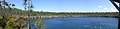
 View from Saddleback Cay
 -
 Sunset from Blanket Sound
 -
 Captain Morgan's Cave
 -
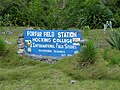 Forfar Field Station
 -
 Church's Blue Hole
 -
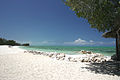 The North Beach of Small Hope Bay Lodge


See also
References
- ^ "List of Islands by Size". WikiPedia.
- ^ "Bahamas Out Islands".
- ^ "National Geographic/ Aug 2010, Blue Holes".
- ^ "Google Distance Calculator".
- ^ "AUTEC website".
- ^ . http://www.aferry.co.uk/bahamas-ferry-uk.htm.
{{cite web}}: External link in|publisher=|title=(help); Missing or empty|url=(help) - ^ http://www.bahamas.gov.bs/bahamasweb/port+department1/sitehome.nsf/subjects/mail+boat+schedule.
{{cite web}}: Missing or empty|title=(help) - ^ "Geography of the Bahamas".
- ^ "Bahamas Travel Guide/Weather".
- ^ "Bahamas Weather".
- ^ About Us "Western Air website".
{{cite web}}: Check|url=value (help) - ^ [www.androsia.com "Androsia Website"].
{{cite web}}: Check|url=value (help) - ^ "Andros Vacation Information".
- ^ "ANCAT Website". Andros Conservancy and Trust (ANCAT).
- ^ "Andros". Retrieved 20 December 2010.
- ^ "International Field Studies".
- ^ [www.smallhope.com "SmallHope Bat"].
{{cite web}}: Check|url=value (help) - ^ "The Bahamas Guide, Andros Islabd".
- ^ Brown, Dick (1993). Flyfishing for Bonefish. Lyons Press. p. 1.
- ^ Randolph, Ph.D., Logan (1994). An Ethnobotanical Investigation of Andros, Island, Bahamas,. pp. 3–4.
- ^ Campbell, David (1978, 1991). The Ephemeral Islands, A Natural History of the Bahamas. p. 49.
{{cite book}}: Check date values in:|year=(help) - ^ "www.geography.org".
- ^ Carr, Michael. "Water, Precious Water". Sail.net Sailing Community.
- ^ Campbell, David. The Ephemeral Islands, A Natural History of the Bahamas. p. 34.
- ^ Brudenell-Bruce, P.B.C. (1975, 1988). The Birds of New Providence and the Bahama Islands. Collins. pp. 10, 13.
{{cite book}}: Check date values in:|year=(help) - ^ Wilson Ornithological Society. http://www.jstor.org/pss/4160537.
{{cite web}}: Missing or empty|title=(help) - ^ "TheBahamian.Com/Andros".
- ^ "The Bahamian.com/Andros".
- ^ Campbell, David. The Ephemeral Islands, A Antural History of the Bahamas. p. 42.
- ^ Rob Palmer, Deep into Blue Holes. Unwin Hyman Limited, 1989. ISBN 0-04-440380-1.
- ^ "First Ever Lucayan Canoe Found in Bahamas". The Roue Holes Foundationb Palmer Bl.
- ^ Riley. Homeward Bound. pp. 180, 185.
- ^ Randolph, Ph.D., Logan (1994). An Ethnobotanical Investigation. p. 5.
- ^ Howard, Rosalyn (2002). Black Seminoles in the Bahamas. University Press of Florida.
- ^ Randolph, Ph.D, Logan. An ethonbotanical Investigation. pp. 13, 15.
- ^ Craton & Saunders, Michael & Gail. Islanders in the Stream. pp. 144–152.
- ^ Riley, Sandra (1989). Homeward Bound, A History of the Bahamas to 1850. Island Research Press. pp. 38, 50.
- ^ McMorran, Jennifer. ThIslands of the Bahamas. e. p. 271.
- ^ Craton & Saunders, Michael & Gail (1998). Islanders in the Stream, A History of the Bahamian People from the end of Slavery to the Twenty-First Century. University of Georgia Press. p. 148.
- ^ Riley. Homeward Bound. p. 80.
- ^ "History of DSV Alvin". Woods Hole Institute.
- ^ "Elections in the Bahamas". Wikipedia.
- ^ "David Doubilet Biography" (PDF). David Doubilet.
- ^ "Family Island District Councillors & Town Committee Members". Retrieved 20 December 2010.
- ^ ernment--Family+Island+Councillors!Opendocument "Family Island District Councillors & Town Committee Members". Retrieved 20 December 2010.
{{cite web}}: Check|url=value (help) - ^ About+the+Government--Family+Island+Administrators!Opendocument "Posting of Administrators As at 5th January, 2010". Retrieved 20 December 2010.
{{cite web}}: Check|url=value (help) - ^ home.nsf/vContentW/GOV--About+the+Government--Family+Island+Councillors!Opendocument "Family Island District Councillors & Town Com mittee Members". Retrieved 20 December 2010.
{{cite web}}: Check|url=value (help) - ^ "?".[dead link]
- ^ "Archdiocese of Nassau homepage". Retrieved 20 December 2010.