
Anatolia
- For the saint, see Saint Anatolia.
This article may require copy editing for grammar, style, cohesion, tone, or spelling. (September 2007) |

Anatolia (Turkish: Anadolu; derives from Ancient Greek: Ανατολία, "Anatolía" (East)) is a geographic region with two related but distinctly different senses of meaning (in English-language usage) that are usually clear from the context.
The term refers to both the greater region, the peninsula of Southwest Asia often called by the Latin name of Asia Minor, and (somewhat incorrectly) the smaller upland region within, known more properly as the Anatolian Plateau (covered below). The peninsular region comprises the greater Asian part of the modern country of Turkey (covering 96% of its land area), as opposed to its European portion (known as Thrace or Rumelia) (4 %).[citation needed]
Etymology
The name Anatolia comes from the Greek Aνατολή (Αnatolḗ) or Ανατολία (Anatolía), which means "East",[1] and likely dates back at least three thousand years, from the Ionian settlement period circa the 1st millenium BC. (See also Ionian League). The Byzantine Greek term Anatolikon ("Eastern Ones") signified the lands to the east of Europe and of the Byzantine Empire's capital city of Constantinople (now Istanbul).[2]
The Turkish form Anadolu derives from the Greek version – both of which predated the growth of Constantinople across the Bosporus strait to both continental shores. Turkish folk etymology further breaks down the geographical term into two words, Ana ("mother") and Dolu ("full"), thus "Full of Mothers", and this fancy is used to advance a pedagogical ideal: Women's contribution of mother's milk to national masculine bravery.[3] Less literally, it is sometimes interpreted as Mother of Cities, perhaps dating to the pre-Islamic era when the Byzantine Empire was the biggest international power known in that part of Asia, and occupied the entire region.
History
Its strategic location is at the intersection of Asia and Europe, making Anatolia a cradle for several civilizations since prehistoric ages, with Neolithic settlements such as Çatal Hüyük (Pottery Neolithic), Çayönü (Pre-Pottery Neolithic A to pottery Neolithic), Nevali Cori (Pre-Pottery Neolithic B), Hacilar (Pottery Neolithic), Göbekli Tepe (Pre-Pottery Neolithic A) and Mersin. The settlement of Troy starts in the Neolithic and continues forward into the Iron Age.
Through its recorded history, Anatolians have spoken both Indo-European and Semitic languages, as well as many languages of uncertain affiliation. In fact, given the antiquity of the Indo-European Hittite and Luwian languages, some scholars have proposed Anatolia as the center from which the Indo-European languages radiated. Other authors have proposed an Anatolian origin for the Etruscans of ancient Italy and the Elymians of Sicily. Historically known peoples that have settled in or conquered Anatolia include the Leleges, Colchians, Hattians, Luwians, Hittites, Phrygians, Cimmerians, Lydians, Lycians, Pisidians, Pamphylians, Persians, Celts, Tabals, Meshechs, Greeks, Pelasgians, Assyrians, Armenians, Romans, Goths, Arabs, Kurds, Byzantines, Seljuk Turks and Ottomans. These peoples belonged to many varied ethnic and linguistic groups.
Today the inhabitants of Anatolia are mostly native speakers of the Turkish language, which was introduced with the conquest of Anatolia by Turkic peoples and the rise of the Seljuk Empire in the 11th century. However, Anatolia remained multi-ethnic until the early 20th century (see Rise of Nationalism under the Ottoman Empire). The last population exchange between Greece and Turkey, occurring as result of the Treaty of Lausanne, moved most of the Turks in Greece to Turkey and vice versa.. A significant Kurdish ethnic and linguistic minority exists in the southeastern regions, while Armenians and Georgians (see Chveneburi) have a presence in the northeast.
Geography

The Anatolian peninsula is bounded by the Black Sea to the north, the Mediterranean Sea to the south, the Aegean Sea (itself an arm of the Mediterranean) to the west, and the bulk of the Asian mainland to the east.
Anatolia's terrain is structurally complex. A central massif composed of uplifted blocks and downfolded troughs, covered by recent deposits and giving the appearance of a plateau with rough terrain, is wedged between two folded mountain ranges that converge in the east. True lowland is confined to a few narrow coastal strips along the Black Sea and Mediterranean Sea coasts. Flat or gently sloping land is rare and largely confined to the deltas of the Kızıl River, the coastal plains of Çukurova, and the valley floors of the Gediz River and the Büyük Menderes River, and some interior high plains in Anatolia, mainly around Tuz Gölü (Salt Lake) and Konya Ovası (Konya Basin).
Background
The Black Sea region has a steep, rocky coast with rivers that cascade through the gorges of the coastal ranges. The North Anatolian mountains are an interrupted chain of folded highlands that generally parallel the Black Sea coast. A few larger rivers, those cutting back through the Pontic Mountains (Turkish: Doğu Karadeniz Dağları), have tributaries that flow in broad, elevated basins. Rivers flow from the mountains toward the Black Sea trough in lengthy valleys.
Access inland from the coast is limited to a few narrow valleys because mountain ridges, with elevations of 1,525 to 1,800 metres (5,000 to 5,900 ft) in the west and 3,000 to 4,000 metres (10000 to 13000 ft) in the east in Kaçkar Mountains, form an almost unbroken wall separating the coast from the interior. The higher slopes facing southwest tend to be densely wet. Because of these natural conditions, the Black Sea coast historically has been isolated from Anatolia. The southern slopes—facing the Anatolian Plateau—are mostly unwooded, but the northern slopes contain dense growths of both deciduous and evergreen trees.

The narrow coastal plains of the Mediterranean region, separated from the Anatolian plateau by the Taurus Mountains, which reach elevations of 2,000 to 2,750 metres (6600 to 9000 ft), are cultivated intensively. Fertile soils and a warm climate make the Mediterranean coast ideal for growing citrus fruits, grapes, figs, bananas, various vegetables, barley, wheat, and, in irrigated areas, rice and cotton. The Çukurova in the east is a plain that is the most developed agricultural area of the Mediterranean region.
Stretching inland from the Aegean coastal plain, Central Anatolia occupies the area between the two zones of the folded mountains, extending east to the point where the two ranges converge. The plateau-like, semiarid highlands of Anatolia are considered the heartland of the country. The region varies in elevation from 600 to 1,200 metres (2000 to 4000 ft) from west to east. The two largest basins on the plateau are the Konya Ovası and the basin occupied by the large salt lake, Tuz Gölü. Both basins are characterized by inland drainage. Wooded areas are confined to the northwest and northeast of the plateau.
Eastern Anatolia
Eastern Anatolia, where the Pontus and Taurus mountain ranges converge, is rugged country with higher elevations, a more severe climate, and greater precipitation than are found on the Anatolian Plateau. The region is known as the Anti-Taurus, and the average elevation of its peaks exceeds 3,000 m. Mount Ararat, at 5,137 metres (16854 ft) the highest point in Turkey, is located in the Anti-Taurus. Lake Van is situated in the mountains at an elevation of 1,546 metres (5072 ft). The headwaters of three major rivers arise in the Anti-Taurus: the east-flowing Aras, which empties into the Caspian Sea; the south-flowing Euphrates and Tigris join in Iraq before emptying into the Persian Gulf. Several small streams that empty into the Black Sea or landlocked Lake Van also originate in these mountains.
Southeast Anatolia lies south of the Anti-Taurus Mountains. It is a region of rolling hills and a broad plateau surface that extends into Syria. Elevations decrease gradually, from about 800 metres (2600 ft) in the north to about 500 metres (1600 ft) in the south. Traditionally, wheat and barley were the main crops of the region, but the inauguration of major new irrigation projects in the 1980s has led to greater agricultural diversity and development.
Anatolian Plateau

Mountains close to the coast prevent Mediterranean influences from extending inland, giving the interior of Turkey a continental climate with distinct seasons. The Anatolian Plateau is much more subject to extremes than are the coastal areas. Winters on the plateau are especially severe. Temperatures of -30 °C to -40 °C (-22 °F to -40 °F) can occur in the mountainous areas in the east, and snow may lie on the ground 120 days of the year. In the west, winter temperatures average below 1 °C (34 °F). Summers are hot and dry, with temperatures above 30 °C (86 °F). Annual precipitation averages about 400 mm (15.7 inches), with actual amounts determined by elevation. The driest regions are the Konya Ovası and the Malatya Ovası, where annual rainfall frequently is less than 300 mm (11.8 inches). May is generally the wettest month and July and August are the driest.
Ecoregions of Anatolia

Anatolia's diverse topography and climate has encouraged a similar diversity of plant and animal communities. The mountains and coastal plain of northern Anatolia, with its humid and mild climate, is home to temperate broadleaf, mixed, and coniferous forests. The central and eastern plateau, with its drier continental climate, is home to deciduous forests and forest steppes. Western and southern Anatolia, which have a Mediterranean climate, are home to Mediterranean forests, woodlands, and shrub ecoregions.
- Temperatures of Anatolia
-
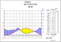 Ankara (central Anatolia)
 -
 Antalya (southern Anatolia)
 -
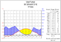 Van (eastern Anatolia)


The given names Anatoly and Anatole
The masculine given name Anatoly, common in Russia and Ukraine, and the Western European variant Anatole, common in France and other French-speaking countries, derive from "Anatolia".[citation needed]
References
- ^ [1]
- ^ "On the First Theme, Called Anatolikon. This theme is called Anatolikon, not because it is above and in the direction of the east whence the sun rises, but because it lies east of us who are the inhabitants of Byzantium and Europe." Constantine VII Porphyogenitus, De Thematibus, ed. A. Pertusi. Vatican: Biblioteca Apostolica Vaticana, 1952, pp. 59-61.[clarification needed]
- ^ Sam Kaplan, "Din-u Devlet All Over Again?", International Journal of Middle East Studies, 34:117 (2002)
See also
- Hittites
- Etruscans
- Phrygia
- Armenia
- Ancient Greece
- Lydia
- Lycia
- Caria
- Pamphylia
- Cilicia
- Lazistan
- Pontus
- Byzantine Empire
- Ottoman Empire
- Turkey
- Saint Anatolia, Roman Catholic Saint
- Anatolian Bulgarians
| States that ruled over Anatolia | ||
|---|---|---|
| Old Kingdom | Ionia | Byzantine Empire |
| New Kingdom | Hellenistic Greece | Nicaean Empire |
| Neo-Hittite | Pergamon | Ottoman Empire |
| Urartu | Persian Empire | Roman Greece |
| Republic of Turkey | Armenia | |

Template:Turkey-related topics