Baturité
Baturité | |
|---|---|
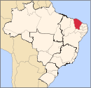
 Location in Ceará state | |
| Coordinates: 04°19′44″S 38°53′06″W / 4.32889°S 38.88500°W | |
| Country | Brazil |
| Region | Northeast |
| State | Ceará |
| Government | |
| • Mayor | Francisco de Assis Germano Arruda (PDT) |
| Area | |
| • Total | 308,780 km2 (119,220 sq mi) |
| Population | |
| • Total | 33,326 |
| • Density | 0.11/km2 (0.28/sq mi) |
| Time zone | UTC– 03:00 (BRT) |
Baturité is a city of Ceará State, Brazil 80 km (50 mi) from the state capital Fortaleza. It is located in the microregion of Baturité. The population estimate in 2004 was 31,124 inhabitants.
Economy

The economy of Baturité is mainly agricultural and based on the cultivation of cotton, sugar cane, rice, maize and beans.
History
Baturité received the first railway in the state of Ceará. It started to operate in 1873. Today, this train station is a museum.
References
- ^ IBGE (10 October 2002). "Área territorial oficial". Resolução da Presidência do IBGE de n° 5 (R.PR-5/02). Retrieved 5 December 2010.
- ^ "Censo Populacional 2010". Censo Populacional 2010. Instituto Brasileiro de Geografia e Estatística (IBGE). 29 November 2010. Retrieved 11 December 2010.
- ^ http://www.estacoesferroviarias.com.br/ce_crato/baturite.htm


