Lymington River
| River Lymington or Lymington River Highland Water | |
|---|---|
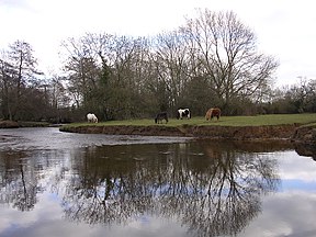
 New Forest ponies grazing next to the Lymington River near Brockenhurst | |
| Location | |
| Country | England |
| Region | Hampshire |
| District | New Forest |
| Physical characteristics | |
| Source | |
| • location | Ocknell Plain |
| • coordinates | 50°54′43″N 1°39′22″W / 50.912°N 1.656°W |
| • elevation | 105 metres (344 ft) |
| Mouth | |
• location | Lymington |
• coordinates | 50°45′00″N 1°31′59″W / 50.750°N 1.533°W |
• elevation | 0 metres |
| Length | 22 km (14 mi) |
| Basin features | |
| Tributaries | |
| • left | Long Brook, Bagshot Gutter, Etherise Gutter |
| • right | Warwickslade Cutting, Fletchers Water, Ober Water, Passford Water |
The Lymington River runs 22 kilometres (14 mi) in south-west Hampshire, England, draining a large central and north-west portion of the New Forest into the Solent at the town of Lymington. The initial part, north of one of the main villages in the heathland-based forest, Brockenhurst, is known as Highland Water and has an adjacent, similar source-distance headwater, Bratley Water, becoming with many nearby, dendritic feeders Fletchers Water.
Highland Water rises north of the Ocknell Inclosure (SU243125) and flows for 10 kilometres (6 mi) to Bolderford Bridge (SU291041) where it meets Ober Water, from there, known as the Lymington River which flows for 12 kilometres (7 mi) to (SZ3493).
History
In 1731 a merchant navy captain, Captain Cross, constructed a causeway and bridge across the estuary to the north of Lymington.[1] He built toll houses and charged travellers using his causeway, more than a mile south of the existing bridge at Boldre.[2] The dam impeded the river and further silted up Lymington harbour.[2] Lymington Corporation pursued the matter in court and lost their case.[2]
In 1795 the mud building up in the estuary "has rendered it already very narrow; and will probably in a few years, so completely choke it up, as to make it unnavigable by any ships of considerable burden."[3]
The causeway was taken over by the regional rail firm who collected the tolls until, after nationalised rail, it was bought out by Hampshire County Council in 1955 – tolls paid down the price and ceased a few years later.[2] Today silting in the harbour as a result of the structure (almost a dam) occurs, but is ameliorated a higher sea level and the scouring effects of the Isle of Wight ferries.[1] Before the structure it is said the diurnal tide influenced flow up to Brockenhurst.[4]
Against the sea, the outer limit of the end of the estuary's mud at low tide is 550–650 metres closer to land than in 1895.[5]
Reedbeds
The river's extensive reedbeds are a Site of Special Scientific Interest.
References
- ^ a b Peter Bruce (2001) Solent Hazards, page 63 ISBN 187168031X
- ^ a b c d Jude James (2013) Lymington Through Time ISBN 1445629364
- ^ D. Y. (1795) Collections for the history of Hampshire, and the bishopric of Winchester: Including the Isles of Wight, Jersey, Guernsey, and Sarke, Volume 1, Section 2, page 24
- ^ David William Garrow (1825) The history of Lymington, and its immediate vicinity, page 29
- ^ https://maps.nls.uk/geo/explore/#zoom=14&lat=50.74035&lon=-1.52865&layers=6&b=7
External links
![]() Media related to Lymington River at Wikimedia Commons
Media related to Lymington River at Wikimedia Commons


