Barrolândia
Barrolândia | |
|---|---|
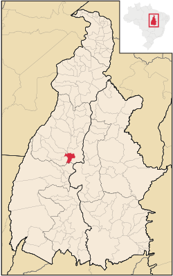
 Location in Tocantins state | |
| Coordinates: 9°50′9″S 48°43′30″W / 9.83583°S 48.72500°W | |
| Country | Brazil |
| Region | North |
| State | Tocantins |
| Area | |
| • Total | 713 km2 (275 sq mi) |
| Population (2020 [1]) | |
| • Total | 5,651 |
| • Density | 7.9/km2 (21/sq mi) |
| Time zone | UTC−3 (BRT) |
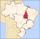
Barrolândia is a municipality located in the Brazilian state of Tocantins. Its population was 5,651 in 2020 and its area is 713 km2.[2]
References[edit]
- ^ "IBGE 2020". Retrieved 26 January 2021.
- ^ IBGE - [1]


