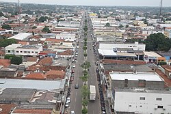
Gurupi
| Município de Gurupi Gurupi |
|||
|---|---|---|---|
|
|
|||
| Coordinates | 11 ° 44 ′ S , 49 ° 4 ′ W | ||
 Location of Gurupi in the state of Tocantins Location of Gurupi in the state of Tocantins
|
|||
| Symbols | |||
|
|||
| founding | November 14, 1958 | ||
| Basic data | |||
| Country | Brazil | ||
| State | Tocantins | ||
| ISO 3166-2 | BR-TO | ||
| Mesoregion | Ocidental do Tocantins (1989-2017) | ||
| Microregion | Gurupi (Tocantins) (1989-2017) | ||
| structure | 1 multiple district | ||
| height | 287 m | ||
| climate | Aw, tropical | ||
| surface | 1,836.1 km² | ||
| Residents | 76,755 (2010) | ||
| density | 41.8 Ew. / km² | ||
| estimate | 86,647 Ew. (July 1, 2019) | ||
| Parish code | IBGE : 1709500 | ||
| Time zone | UTC −3 | ||
| Website | www.gurupi.to.gov.br (Brazilian Portuguese) | ||
| politics | |||
| City Prefect | Laurez da Rocha Moreira (2017-2020) | ||
| Political party | PSB | ||
| Culture | |||
| Patron saint | Santo Antonio de Lisboa | ||
| economy | |||
| GDP | 1,844,780 thousand R $ 22,039 R $ per person (2015) |
||
| HDI | 0.759 (2010) | ||
Gurupi , officially Município de Gurupi , is a city founded in 1958 in the Brazilian state of Tocantins in the Região Norte . It is 245 km from the capital of Palma . The population was estimated on July 1, 2019 at 86,647 inhabitants, called Gurupienser (Portuguese gurupienses ), who live in an area of around 1836 km². The population density is 47 people per km². It is the third most populous city in Tocantins.
geography
The municipality forms a watershed between the Rio Araguaia and Rio Tocantins rivers .
The landscape and climate are those of the Brazilian Cerrado . There is a tropical savanna climate, according to the Köppen and Geiger Aw climate classification . The height above sea level is 287 meters.
Surrounding towns are:
| Northwest: Dueré | North: Aliança do Tocantins | Northeast: |
| West: Cariri do Tocantins |

|
East: Peixe |
| Southwest: | South: Cariri do Tocantins , Sucupira , Figueirópolis | Southeast: |
City administration
Executive: In the local elections in 2016 , Laurez da Rocha Moreira was elected city prefect (mayor) for the term from 2017 to 2020. He is a member of the Partido Socialista Brasileiro (PSB).
The legislature lies with a 13-member city council, the vereadores of the Câmara Municipal, 2017/2018 the presidency lies with Antonio Valdônio Rodrigues Loiola, who is also a member of the PSB.
Population development
Source: IBGE (figures for 2019 are only estimates). In 2010, 24.79% of the population were children and adolescents up to the age of 15. In 2010, 97.71% lived in urban areas and 2.29% in extensive rural areas.

Standard of living
The human development index for cities, abbreviated HDI (Portuguese: IDH-M ), was at the low value of 0.497 in 1991, and at the high value of 0.764 in 2010.
literature
- Secretaria do Planejamento e Orçament (SEPLAN): Gurupi 2017 . Ed .: Governo do Estado do Tocantins (= Perfil Socioeconômico dos Municípios ). Palmas 2017 (Brazilian Portuguese, online [PDF]).
Web links
- City Prefecture website , Prefeitura Municipal (Brazilian Portuguese)
- City Council website , Câmara Municipal (Brazilian Portuguese)
Individual evidence
- ↑ a b c d IBGE : Tocantins: Gurupi - Panorama. Retrieved October 1, 2018 (Brazilian Portuguese).
- ↑ Laurez Moreira 40. In: com.br. Eleições 2016, accessed January 21, 2018 (Portuguese).
- ↑ Mesa Diretora - Câmara de Gurupi. In: leg.br. www.gurupi.to.leg.br, accessed January 21, 2018 (Brazilian Portuguese).
- ↑ a b Atlas do Desenvolvimento Humano do Brasil: Gurupi. Retrieved January 21, 2018 (Brazilian Portuguese).


