Boistfort Peak: Difference between revisions
Content deleted Content added
m tweak map |
Changed the call sign of the 2 meter ham repeater from WA7UHD to K7PG reflected the clubs call sign change |
||
| (2 intermediate revisions by 2 users not shown) | |||
| Line 1: | Line 1: | ||
{{short description|Mountain in Washington, United States}} |
|||
{{Infobox mountain |
{{Infobox mountain |
||
| name = Boistfort Peak |
| name = Boistfort Peak |
||
| Line 30: | Line 31: | ||
}} |
}} |
||
'''Boistfort Peak''', also called '''Baw Faw Peak''' is a peak in the [[Willapa Hills]] in [[Washington (state)|Washington]] state. The summit was once the site of a [[fire lookout]] and is the highest point in the Willapa Hills.<ref> |
'''Boistfort Peak''', also called '''Baw Faw Peak''', is a peak in the [[Willapa Hills]] in [[Washington (state)|Washington]] state. The summit was once the site of a [[fire lookout]] and is the highest point in the Willapa Hills.<ref> |
||
{{cite web |
{{cite web |
||
| url = http://www.firelookout.com/wa/bawfaw.html |
| url = http://www.firelookout.com/wa/bawfaw.html |
||
| Line 36: | Line 37: | ||
| publisher = Rex's Forest Fire Lookout Page |
| publisher = Rex's Forest Fire Lookout Page |
||
| accessdate = 2008-12-03 }}</ref> |
| accessdate = 2008-12-03 }}</ref> |
||
Today it has communication [[antenna (radio)|antennae]] including the |
Today it has communication [[antenna (radio)|antennae]] including the K7PG [[2-meter band|2-meter]] [[amateur radio|ham]] [[repeater]]. It also is the site of station ''BOW'' in the [[Pacific Northwest Seismic Network]].<ref> |
||
{{cite web |
{{cite web |
||
| url = http://www.pnsn.org/WEBICORDER/webimaps.html |
| url = http://www.pnsn.org/WEBICORDER/webimaps.html |
||
| Line 46: | Line 47: | ||
| archivedate = 2008-12-16 |
| archivedate = 2008-12-16 |
||
}}</ref> |
}}</ref> |
||
==References== |
|||
{{reflist}} |
|||
==References== |
==References== |
||
Latest revision as of 14:54, 28 June 2023
| Boistfort Peak | |
|---|---|
| Highest point | |
| Elevation | 3,113 ft (949 m) NAVD 88[1] |
| Prominence | 2,680 ft (820 m)[2] |
| Coordinates | 46°29′17″N 123°12′55″W / 46.488145508°N 123.215308036°W[1] |
| Geography | |
| Location | Lewis County, Washington, U.S. |
| Parent range | Willapa Hills, Pacific Coast Ranges |
| Topo map | USGS Boistfort Peak |
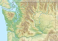
Boistfort Peak, also called Baw Faw Peak, is a peak in the Willapa Hills in Washington state. The summit was once the site of a fire lookout and is the highest point in the Willapa Hills.[3] Today it has communication antennae including the K7PG 2-meter ham repeater. It also is the site of station BOW in the Pacific Northwest Seismic Network.[4]
References[edit]
- ^ a b "Baw Faw". NGS Data Sheet. National Geodetic Survey, National Oceanic and Atmospheric Administration, United States Department of Commerce. Retrieved 2008-12-03.
- ^ "Boistfort Peak, Washington". Peakbagger.com. Retrieved 2008-12-03.
- ^ "Baw Faw (Boistfort) Lookout". Rex's Forest Fire Lookout Page. Retrieved 2008-12-03.
- ^ "Webicorder Maps". The Pacific Northwest Seismic Network. Archived from the original on 2008-12-16. Retrieved 2008-12-03.
External links[edit]
- "Boistfort Peak". Geographic Names Information System. United States Geological Survey, United States Department of the Interior. Retrieved 2008-12-03.
- "Baw Faw Repeater Group". Archived from the original on 2008-08-20. Retrieved 2008-12-03.

