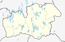
Älghult
| Älghult | ||||
|
||||
| State : | Sweden | |||
| Province (län): | Kronobergs län | |||
| Historical Province (landskap): | Småland | |||
| Municipality : | Uppvidings | |||
| Coordinates : | 57 ° 1 ′ N , 15 ° 34 ′ E | |||
| SCB code : | 2040 | |||
| Status: | Crime scene | |||
| Residents : | 497 (December 31, 2015) | |||
| Area : | 0.98 km² | |||
| Population density : | 507 inhabitants / km² | |||
| List of perpetrators in Kronobergs län | ||||
Älghult is a place ( Tatort ) in the municipality Uppvidinge in the Swedish province of Kronobergs län and the historical province of Småland . Until 1971, Älghult was an independent rural community.
There is a church worth seeing, a primary school, a kindergarten, a retirement home, a small supermarket, a gas station as well as small and medium-sized businesses and a few retailers.
Individual evidence
- ↑ a b Statistiska centralbyrån : Land area per Tatort, folkmängd and invånare per square kilometer. Vart femte år 1960 - 2015 (database query)

