Îlot Saint Christophe
| Îlot Saint Christophe | ||
|---|---|---|
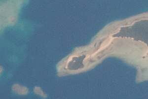
| Satellite photo of the Îlot Saint Christophe | ||
| Waters | Pacific Ocean | |
| Archipelago | Wallis Islands | |
| Geographical location | 13 ° 22 ′ S , 176 ° 13 ′ W | |
|
|
||
| length | 0.24 km | |
| width | 0.19 km | |
| surface | 0.025 km² | |
| Residents | uninhabited | |
| View from Nukuatea to the Îlot Saint Christophe | ||
The Îlot Saint Christophe (also Îlot St. Christophe ) is an island of the Wallis Islands and politically belongs to the Muʻa district in the Kingdom of Uvea , which forms part of the French overseas territory of Wallis and Futuna .
geography
The Îlot Saint Christophe is located 1.75 km south of Uvea and is partly connected to the southeastern neighboring island of Nukuatea , which is significantly larger than the Îlot Saint Christophe, via a sandbank almost 300 meters long . The island is a small mountain covered with trees .
use
Although the island is uninhabited, the Chapelle de St. Christophe is located on the mountain top . A short serpentine path leads from the beach up the mountain to the chapel . There is also a small covered hut on the large beach area of the island. The island is also a tourist destination for vacationers on Uvea.
Individual evidence
- ↑ Les_îlots. Retrieved May 11, 2017 .
- ↑ France Hardy: îlot saint Christophe - hardysfamilywallis.over-blog.com . In: hardysfamilywallis.over-blog.com . ( over-blog.com [accessed May 11, 2017]).


