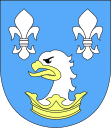
Świekatowo
| Świekatowo | ||
|---|---|---|

|
|
|
| Basic data | ||
| State : | Poland | |
| Voivodeship : | Kuyavian Pomeranian | |
| Powiat : | Świecki | |
| Geographic location : | 53 ° 25 ' N , 18 ° 6' E | |
| Residents : | 1700 | |
| Postal code : | 86-182 | |
| Telephone code : | (+48) 52 | |
| License plate : | CSW | |
| Economy and Transport | ||
| Rail route : | Wierzchucin – Bydgoszcz | |
| Next international airport : | Bydgoszcz | |
Świekatowo ( German Schwekatowo , 1942–1945 Schweike ) is a village in Poland in the Kuyavian-Pomeranian Voivodeship in the Powiat Świecki . The village is the seat of the rural community of the same name .
The village is located about 35 kilometers north of Bydgoszcz on the Bydgoszcz − Gdynia railway line .
history

In Prussian times (after the partitions of Poland) the village was a royal village with a Catholic church. Around 1900 the place counted approx. 800 inhabitants of German and Polish origin. After the end of the First World War, most of West Prussia - and with it the town of Schwekatowo - became part of the re-established state of Poland; a large part of the German population left the region.
When the Wehrmacht invaded Poland in September 1939, Świekatowo was largely destroyed by fighting on September 2, 1939. In 1942 the place was renamed Schweike after it had been called Schwekatowo in Prussian times (province of West Prussia ) and again from 1939 (in earlier times also called Schwenkotowo or Sickotowo). At the end of the Second World War , the Red Army invaded and the village subsequently became part of Poland again; the German settlement ended. Remnants of the once Protestant cemetery away from the village remind of former German residents.
local community
The rural community Świekatowo consists of 9 districts ( German names until 1945 ) with the Schulzenamt:
|
|
|
traffic
The Świekatowo station on the eastern edge of the village is on the Nowa Wieś Wielka – Gdynia railway line . The Świekatowo Wschodnie station, northeast of the town, is on the former Terespol – Vandsburg railway line ; In 1994, passenger traffic was discontinued and the line was subsequently closed.

