A20 road
| A20 road in the UK | |

|
|
| map | |
| Basic data | |
| Operator: | |
| Start of the street: | London |
| End of street: | Dover |
| Overall length: | 114.6 km (71.2 mi ) |
| The A20 near Swanley (photo 2006) | |
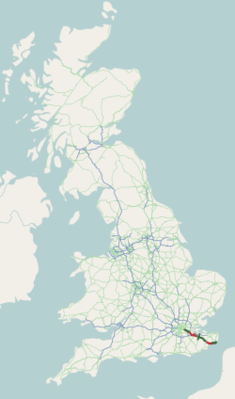
The A20 road ( English for road A20 ) is a 114.6 km long, within the ring of London, the M25 and from Folkestone to its end on the English Channel as the primary route , which leads from London to Dover .
course
The road begins at New Cross in the London suburb of Lewisham . It runs to the southeast, branches off the A21 road and crosses the M25 motorway , the London ring road, at Swanley . The A20 branches off from the M25 and runs parallel to the M25 until Folkestone is no longer designated as a primary route. At Wrotham Heath, the A25 road branches off to the west towards Reigate and Guildford . The A228 road crosses at West Malling . You will then pass through Maidstone , where the A26 road branches off and the A229 road coming from Rochester intersects. The road follows the south edge of the North Downs , runs through Charing and on to Ashford , where the A28 road is crossed. It continues near the M20, passes through Folkestone and becomes the primary route again at the end of the M20, which leads with separate lanes along the cliffs to Dover with its ferry port and then merges into the A2 road .


