A31 road
| A31 road in the UK | |

|
|
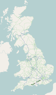
| map | |
| Basic data | |
| Operator: | |
| Start of the street: | Guildford |
| End of street: | Bere regis |
| Overall length: | 140 km (87 mi ) |
| The A31 in St. Leonards (Dorset), photo 2005 | |
The A31 road ( English for road A31 ) is a total of 140 km long, partly replaced by the M3 motorway and the M27 motorway , mostly designated as the primary route in England, which connects Guildford with Winchester , then replaced by the M3 and M27 motorways and starts again at junction 2 of the M27 and continues in a straight line at the end of the M27 (junction 1) and leads via Wimborne Minster to Bere Regis , where it meets and ends on the A35 road leading to Dorchester .
course
The eastern section of the road begins in central Guildford, then crosses A3 road and takes two lanes to Farnham . You continue to Chawton where the A32 road branches off to the south-southwest. The A31 continues in a south-westerly direction, now with two lanes for longer sections, bypassing New Alresford in the south and reaching the east bypass of Winchester. The eastern section ends there. Either the two motorway sections or the A3090 road lead to the western section . This section continues the M27, runs through the New Forest National Park . The A31 crosses the A338 road at Ringwood , with which it runs a short distance, and at Ferndown leaves the straight direction maintained by the A348 road towards Poole . The A31 runs roughly west to Wimborne Minster, then crosses the A350 road and ends in Bere Regis.

