A981 road
| A981 road in the UK | |
| map | |
| Basic data | |
| Operator: | |
| Start of the street: |
Fraserburgh ( 57 ° 41 ′ N , 2 ° 0 ′ W ) |
| End of street: |
New Deer ( 57 ° 31 ′ N , 2 ° 12 ′ W ) |
| Overall length: | 24.9 km (15.5 mi ) |
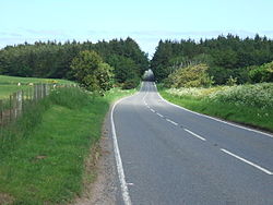
| The A981 south of Memsie | |
|
Course of the road
|
|
The A981 road is an A-road in Scotland . It leads from Fraserburgh at the east end of the Moray Firth through the sparsely populated regions of Aberdeenshire to New Deer .
course
South of the center of Fraserburgh, the A981 branches off from the A90 ( Perth –Fraserburgh). It leads in a south-westerly direction through the southern districts of Fraserburgh and after about four kilometers reaches the village of Memsie , where it crosses the B9032. Eight kilometers to the southwest, the A981 first crosses the B9093 and then connects Strichen to the road network. On the southern edge of the village, it crosses the North Ugie Water on the listed Strichen Bridge , an arched bridge from the 19th century.
Beyond lines, the A981 crosses the A950 ( New Pitsligo - Peterhead ) and merges with it for around 400 m. It crosses two source streams of the South Ugie Water and means the endpoints of the B9028 and B9029 about one kilometer before New Deer. The road bends west and ends in downtown New Deer along with the A948 on the B9170.

