
Malliner water
|
Malliner water lower course alternatively: Aalbach |
||
 Malliner water in the Tillense river system |
||
| Data | ||
| Water code | DE : 96644 | |
| location | Mecklenburg-Western Pomerania , Germany | |
| River system | Peene | |
| Drain over | Tollense → Peene → Baltic Sea | |
| source |
Bornsee 53 ° 28 ′ 17 ″ N , 12 ° 55 ′ 23 ″ E |
|
| muzzle | Northwest of Neubrandenburg in the Tollense coordinates: 53 ° 35 ′ 19 ″ N , 13 ° 14 ′ 16 ″ E 53 ° 35 ′ 19 ″ N , 13 ° 14 ′ 16 ″ E
|
|
| Discharge at the gauge Zirzow A Eo : 312 km² Location: 3 km above the mouth |
NNQ (often 07.1989) MNQ 1963–2005 MQ 1963–2005 Mq 1963–2005 MHQ 1963–2005 HHQ (often 03.1979) |
10 l / s 171 l / s 1.23 m³ / s 3.9 l / (s km²) 4.79 m³ / s 10.9 m³ / s |
 Malliner water at the Zirzower mill |
||
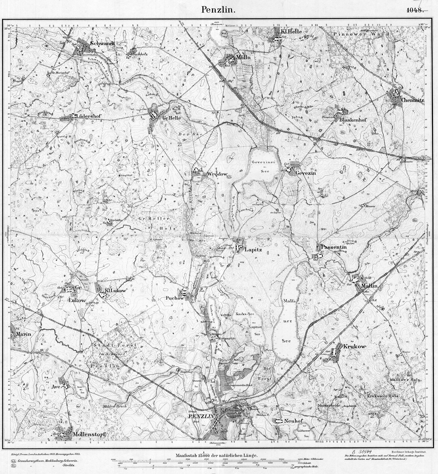
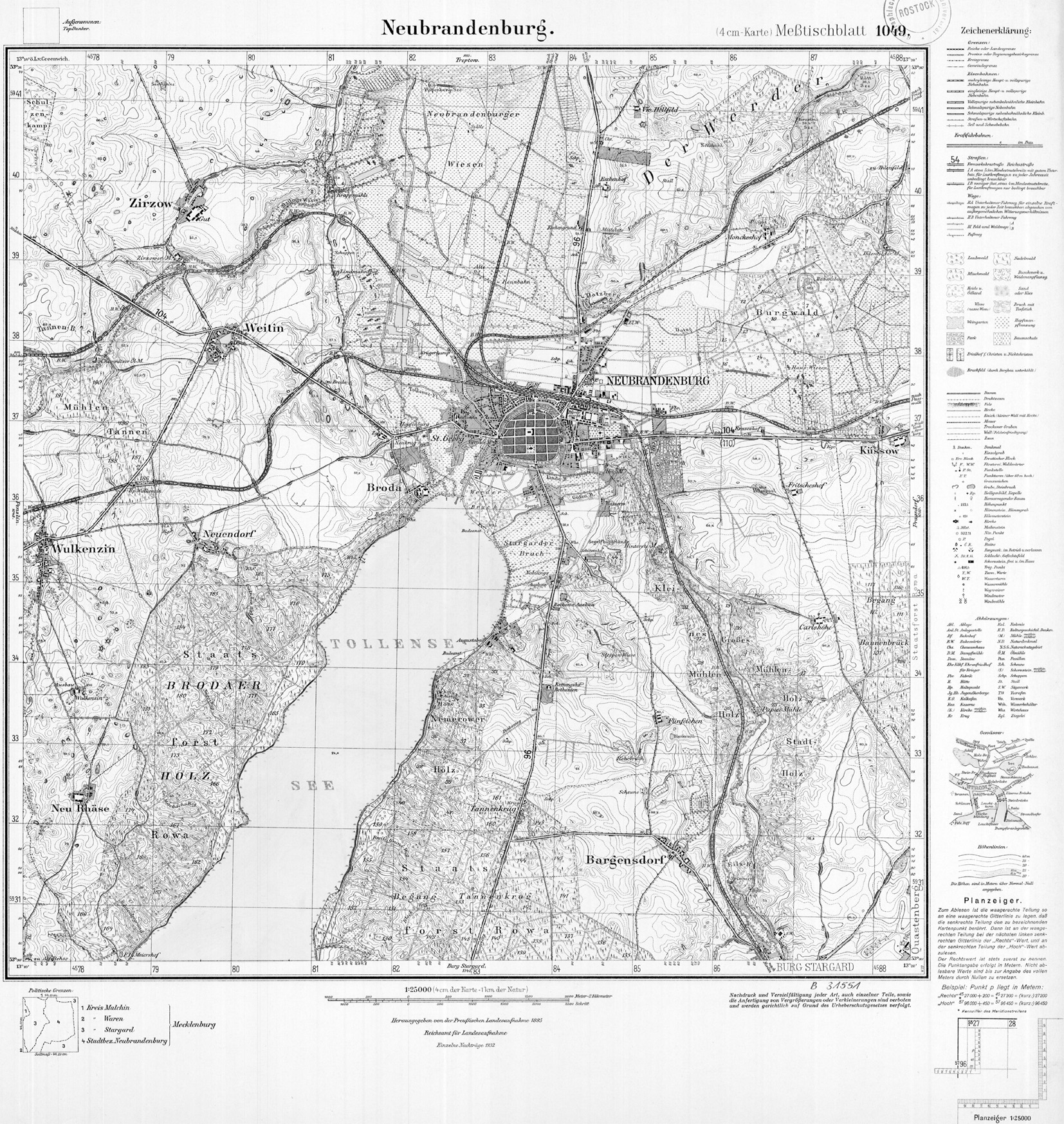
The Malliner water is an eastward flowing left tributary of the Tollense in Mecklenburg-Western Pomerania. Topographically, the Malliner See can be viewed as a starting point. Hydrographically, its main inflow from the Penzlin city lake is also assigned to the Malliner water course , as well as its most important inflow, the Mühlengraben from the Mühlensee near Ankershagen with the Bornsee to the west as the source lake. Shortly below the Malliner See, the Aalbach flows from the north into the Malliner Wasser, which below this confluence is also referred to as Aalbach on some maps, but not in the topographical land survey of the late 19th and early 20th centuries. On the measuring table , for example, in the area shown in the photo of the info box, the name “Malliner Wasser” is written.
"Aalbach" is written in the table sheet at that northern tributary for the last 4 km before it joins the outflow of Lake Mallin. Above that, the use of the name “Aalbach” or “Aal-Beck” is inconsistent and sometimes ambiguous. This body of water may have been considered the main stream in the late 19th and early 20th centuries.
Individual evidence
- ^ German Hydrological Yearbook Coastal Area of the Baltic Sea 2005. (PDF) State Office for Environment and Nature Mecklenburg-Western Pomerania, accessed on October 4, 2017 (German, at: dgj.de).
Web links
-
Map portal Environment Mecklenburg-Western Pomerania : Topic selection → Water → Waters
- → Running waters → LAWA routes
- → standing water → lakes
-
Geographical - geographical collections :
- Measuring table sheet Penzlin from 1883 with name entries "Aal-Beck" between Gr. Helle and Gnevezin and "Lühm-B." Between Mölln and Gnevezin
- Measurement table sheet Neubrandenburg from 1932 with the name “Malliner Wasser” east of Zirzow
- Measurement table sheet Hohenzieritz from 1911 with the name entry "Mühlen-Gr." West of Gr. Thank you