
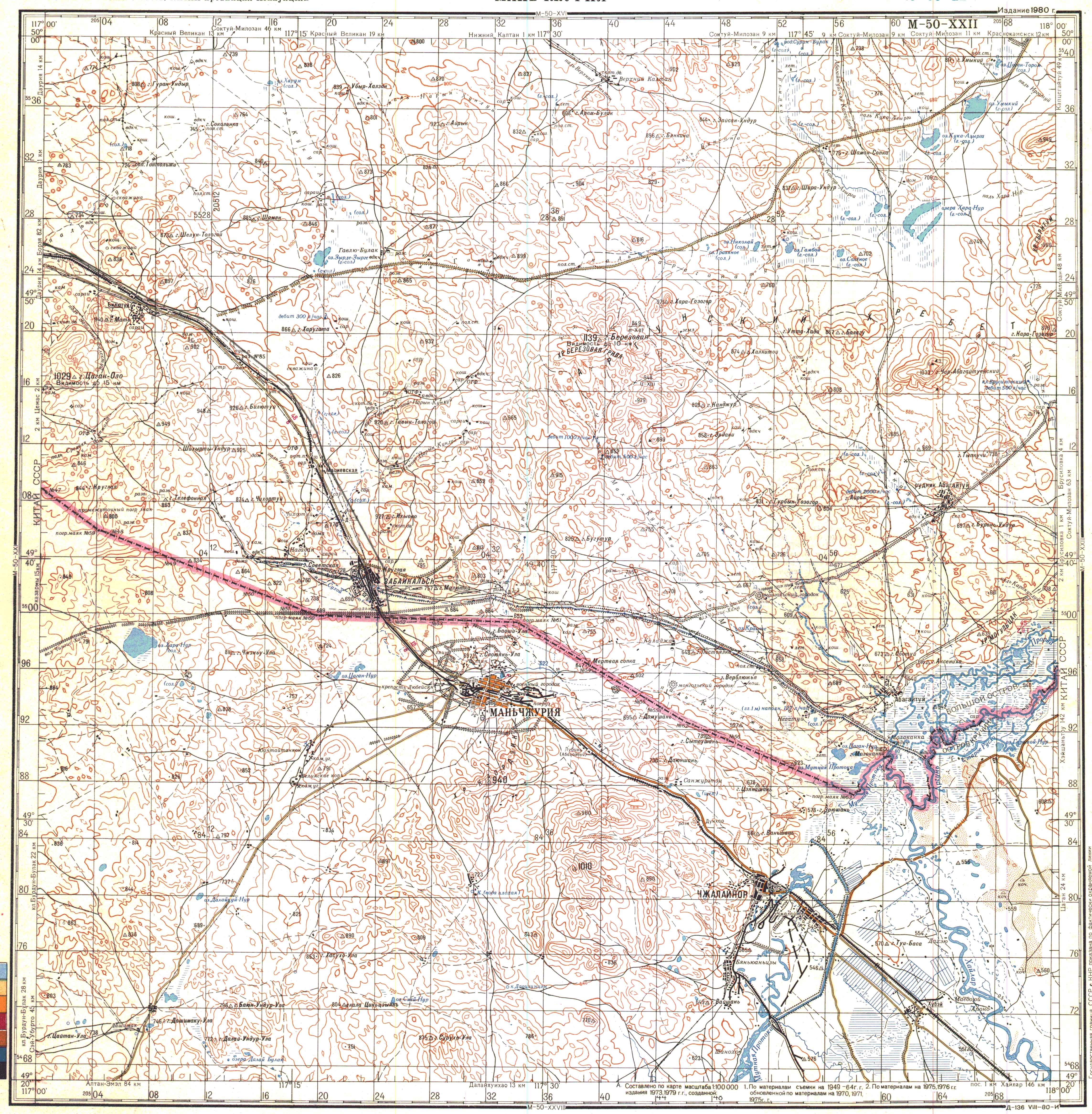
Abagaitu Zhouzhu
Abagaitu Zhouzhu ( Chinese 阿巴 該 圖 洲渚 / 阿巴 该 图 洲渚 , Pinyin Ābāgāitú Zhōuzhǔ ; Russian Большой остров , ie Bolshoi Ostrow , "Big Island") is an island on the Ergun River (Argun) in the administrative area of the Shuangwa Qagan state pasture to the north of the New Left Bargu Banner , which belongs to the city of Hulun Buir in the Inner Mongolia Autonomous Region of the People's Republic of China . A smaller part of the island is on Russian territory and belongs to the Sabaikalski district of the Transbaikalia region .
The island is located in the northwest of Qagan Shuangwas, directly west of Galud , shortly after the Dalang Olom Gol (Russian Мутная протока , Mutnaja Protoka , "Troubled river arm") coming from the Hulun Lake via the urban area of Manjur (Jalainur mining district) which Hailar He united to form the Ergun, and divides it into a western and an eastern arm. These flow around the island northwards. Abagaitu Zhouzhu is uninhabited and has an area of 57.56 km² when the water level is normal, but it is considerably smaller during floods. The swampy island is criss-crossed by numerous inlets and is heavily overgrown with tall reeds and willows. The numerous wild swans , little egrets , cranes and swan geese are particularly noteworthy from their abundant bird life .
origin of the name
The Mongolian name of the island means "where there are women" or "where the women came from". In Yongzheng 5 (1727) the Sino-Russian joint border patrol camped not far from the confluence of the Hailar He and Dalang Olom Gol rivers and was about to get drinking water when a Mongolian woman came with two buckets of water from the direction of the island and offered it to them. As a result, the Chinese officials gave the island (then completely part of China) its current name.
Border question
Abagaitu Zhouzhu was traditionally and undisputed Chinese territory until the Soviet Union occupied the island in the course of the Soviet-Chinese border war in 1929. In the “Supplementary Agreement on the Eastern Part of the Sino-Russian Border between the People's Republic of China and the Russian Federation” of October 14, 2004, Russia undertook to return the larger, northeastern part of the island to China.
In return, China agreed not to raise the demand for the return of the southwestern part of the island and to recognize the emerging border as binding under international law. The extensive surveying and demarcation work of a mixed Chinese-Russian commission was completed at the beginning of October 2008 and 34.55 km² of the island was handed over to China. Russia retained 23.01 km². This made Abagaitu Zhouzhu one of only two places where the Sino-Russian border crosses an island.
See also
Web links
- Russian map showing the whole island (right edge, lower half) as Russian territory.
credentials
- ^ Complementary Agreement between the People's Republic of China and the Russian Federation on the Eastern Section of the China – Russia Boundary. October 14, 2004 ( Memento from August 12, 2011 in the Internet Archive )
- ^ News from August 28, 2008 about the completion of the surveying work for the division of Abagaitu Zhouzhus in the news network of the "People's Daily" - Chinese ( Memento from November 17, 2012 in the Internet Archive )
Coordinates: 49 ° 34 ' N , 117 ° 54' E