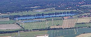
Accumer lake
| Accumer lake | ||
|---|---|---|

|
||
| Aerial view of Accumer Lake | ||
| Geographical location | Lower Saxony , Germany | |
| Places on the shore | Schortens | |
| Data | ||
| Coordinates | 53 ° 32 '29 " N , 8 ° 0' 5" E | |
|
|
||
| Altitude above sea level | 0.5 m above sea level NHN | |
| surface | 36.8 ha | |
| length | 800 m | |
| width | 460 m | |
| volume | 1,970,000 m³ | |
| Maximum depth | 25 m | |
| Middle deep | 5.3 m | |
The Accumer See (also Baggersee Accum) is a quarry pond in the area of the town of Schortens southwest of Accum in the district of Friesland , Lower Saxony .
It was created in the years 1970–1975 by excavating sand for the construction of the Federal Highway 29 .
After the lake was closed to anglers and bathers in 2005 due to blue-green algae , the Oldenburg / Ostfriesland / Wilhelmshaven University of Applied Sciences installed a free jet device for deep water aeration in 2006 . This project, which was supported by the Terramare research center , aimed to pump oxygen-rich surface water into deeper layers and thus curb the blue-green algae bloom.
The lake is used by the sport fishing association Wilhelmshaven eV as fishing waters.
See also
Web links
Commons : Accumer See - collection of images, videos and audio files
- photo
- Water regulations , sport fishing club Wilhelmshaven
- www.anglermap.de: Accumer See water profile (accessed on November 5, 2014)
Individual evidence
- ↑ a b c d e f g Free jet propeller for deep water aeration in Accumer See 2006 (PDF). Institute for Energy, Process and Environmental Technology at the University of Applied Sciences Oldenburg / Ostfriesland / Wilhelmshaven , November 2006. Accessed on January 13, 2014
- ↑ Angler drowned in Accumer Lake . In: Nordwest-Zeitung from July 25, 2008
- ↑ Blue- green algae in the Accumer See: swimming is prohibited . In: Wilhelmshavener Zeitung from August 20, 2005
