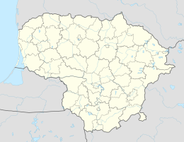
Alksnynė
| Alksnynė / Erlenhorst | ||
| State : |
|
|
| District : | Klaipeda | |
| Municipality : | Neringa | |
| Founded : | 1898-1907 | |
| Coordinates : | 55 ° 38 ′ N , 21 ° 8 ′ E | |
| Time zone : | EET (UTC + 2) | |
| Status: | Location, municipality of Neringa |
|
|
|
||
Alksnynė ( German Erlenhorst ) is a single farm on the Curonian Spit in Lithuania . The homestead is located in the northern part of the Lithuanian side of the spit and belongs to the municipality of Neringa .
The former Erlenhorst dates back to the years between 1898 and 1907 and is located on the banks of the Curonian Lagoon . At that time, the residential area with its dune surveillance station belonged to the Memel district in the Prussian province of East Prussia , and from 1923 to 1939 it belonged to the Memelland . The city of Klaipėda (Memel) is nine kilometers to the northeast and can be reached via the KK 167 regional road through Alksnynė .
Only a few families live in Alksnynė. The Alsmin Bay of the Curonian Lagoon used to be at this point . On the occasion of the deepening of the shipping route, this bay was filled in with the excavated ground. During the planting of the dunes at the end of the 19th century, the dune keeper's homestead was built here and was given the name Alksnynas ( Erlenhorst ).
In this settlement there is now the checkpoint where the fee for entry into the Curonian Spit National Park is collected.
Ecclesiastically, the predominantly Protestant residents of Erlenhorst until 1945 were incorporated into the parish Memel -Land in the church province of East Prussia of the Church of the Old Prussian Union . The reference to Klaipėda still exists today if you belong to the Evangelical Lutheran Church in Lithuania .

