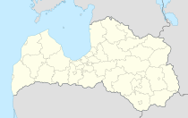
Amata (Latvia)
| Amata | ||
|---|---|---|
 Help on coat of arms |
|
|
| Basic data | ||
| State : |
|
|
| Landscape: | Livonia ( Latvian : Vidzeme ) | |
| Administrative district : | Amatas novads | |
| Coordinates : | 57 ° 13 ' N , 25 ° 18' E | |
| Residents : | 223 | |
| Area : | 108.35 km² | |
| Population density : | 2 inhabitants per km² | |
| Height : | ||
| Website: | www.amatasnovads.lv | |
| Post Code: | ||
| ISO code: | ||
Amata is a place in Latvia , northeast of Riga . In 2019 there are 223 inhabitants.
The name comes from a railway station on the Amata River . The associated route Ieriķi - Abrene is no longer operated. In 1990, the Amata sovkhoz became a municipality, the administrative building of which was in Kosa. Not far from Amata, a settlement with many artificial lakes and summer houses was created, which are offered for sale.
763 inhabitants live in the municipality of Drabeši to which Amata belongs (as of 2016). The municipal administration is located in Ģikši. In the course of the administrative reform since 2009, the village is now part of the Amata district .
literature
- Johannes Feldmann , Heinz von zur Mühlen (Hrsg.): Baltic historical local dictionary, part 2: Latvia (southern Livland and Courland). Böhlau, Cologne 1990, ISBN 3-412-06889-6 , p. 24.
- Astrīda Iltnere (ed.): Latvijas Pagasti, Enciklopēdija. Preses Nams, Riga 2002, ISBN 9984-00-436-8 .
