Amatepec
| Amatepec | ||
|---|---|---|
|
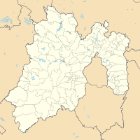
Coordinates: 18 ° 41 ′ N , 100 ° 11 ′ W Amatepec on the map of Mexico
|
||
| Basic data | ||
| Country | Mexico | |
| State | México | |
| local community | Amatepec | |
| City foundation | 16th Century | |
| Residents | 2187 (2010) | |
| City insignia | ||
| Detailed data | ||
| height | 2440 m | |
| Post Code | 51500 | |
| Time zone | UTC −6 summer time (April to October) | |
| City patron | St. Caspar | |
Amatepec is the capital of the municipality of the same name Amatepec in the Mexican state of México .
climate
According to the topographical location, two types of climatic zones are predominant, the temperate and the subtropical climatic zone. The temperature is between 15 and 40 ° C.
| Amatepec | ||||||||||||||||||||||||||||||||||||||||||||||||
|---|---|---|---|---|---|---|---|---|---|---|---|---|---|---|---|---|---|---|---|---|---|---|---|---|---|---|---|---|---|---|---|---|---|---|---|---|---|---|---|---|---|---|---|---|---|---|---|---|
| Climate diagram | ||||||||||||||||||||||||||||||||||||||||||||||||
| ||||||||||||||||||||||||||||||||||||||||||||||||
|
Average monthly temperatures and rainfall for Amatepec
|
|||||||||||||||||||||||||||||||||||||||||||||||||||||||||||||||||||||||||||||||||||||||||||||||||||||||||
history
Pre-Columbian history
There are archaeological sites that were used as defensive garrisons against the Purepechan Empire. The first inhabitants of the region were the Otomí and the Tenochca.
Spanish colonial times
Evangelization began in 1526 and the first encomendero was Don Juan de Saucedo. Mining began in 1531 by a colony of Spanish miners.
economy and society
The typical staple food is corn , but the cultivation of brew fruits and coffee is also a focus. Remittances from Mexicans to the United States mean that much of the economic benefits are lost.
The production of coffee is organized and sustainable as there are many small producers. There is also a coffee producers' cooperative.
Every year on January 6th there is a traditional fair with food, horse racing, bull riding and ballroom dancing from colonial times to independent Mexico. Some examples of folk music are Huapango, Gusto guerrerense, Ranchera and Corrido .


