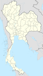
Amnat Charoen
|
อำนาจเจริญ Amnat Charoen |
||
|---|---|---|
|
|
||
| Coordinates | 15 ° 51 ′ N , 104 ° 38 ′ E | |
| Basic data | ||
| Country | Thailand | |
| Amnat Charoen | ||
| ISO 3166-2 | TH-37 | |
Amnat Charoen ( Thai เทศบาล เมือง อำนาจเจริญ ) is a town ( เทศบาล เมือง - Thesaban Mueang ) in Mueang Amnat Charoen County . Amnat Charoen is located in the province of Amnat Charoen in the northeast region of Thailand , the so-called Isan .
geography
Amnat Charoen is located in the far east of the Isan on the border with Laos and is about 580 kilometers from Bangkok . The area is idyllic, but due to its remote location, this is not reflected in any significant tourism.
Economy and Importance
The area is one of the poorest in Thailand, the main industry is agriculture.
The Phuttha Utthayan Reservoir is used for constant artificial irrigation and mainly supplies agriculture.
history
The city of Amnat Charoen received the status of a city under King Nang Klao ( Rama III ) and was initially administered by Nakhon Khemarat and later by Ubon Ratchathani. Amnat Charoen became the capital of the newly founded province on January 12, 1993, which was separated from the Ubon Ratchathani province . Together with the provinces of Nong Bua Lamphu and Sakaeo , Amnat Charoen is one of the three last provinces formed in Thailand.
Attractions
- Wat Mongkhon Ming Mueang ( วัด มงคล มิ่ง เมือง ) - an idyllic Buddhist temple complex ( Wat ) , houses an image of the Buddha with rich gold leaf jewelry.
- Wat Tham Saeng Phet ( วัด ถ้ำ แสง เพชร ) - Buddhist temple complex located on a hill, houses some caves with Buddha images
- Phuttha Utthayan ( พุทธ อุทยาน ) - Buddhist park with Huay Pho reservoir, which is also used as an excursion area.
Web links
- City map of Amnat Charoen (names in English and Thai) [last accessed on November 2, 2013]
