Anselburg
| Anselburg | ||
|---|---|---|
|
Castle hill with remains of a wall |
||
| Alternative name (s): | Anselsburg, Spitzhübel, Spitzer Hübel | |
| Creation time : | before 1419 | |
| Castle type : | Hill castle, moth | |
| Conservation status: | Burgstall, ramparts, remains of walls | |
| Place: | Neuhemsbach | |
| Geographical location | 49 ° 30 '56.3 " N , 7 ° 54' 13.9" E | |
| Height: | 366.8 m above sea level NHN | |
|
|
||
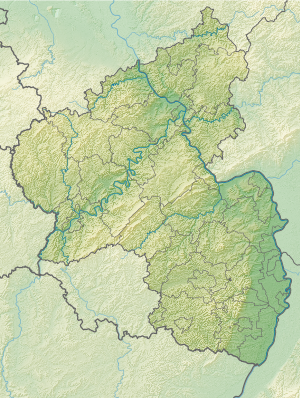
The Ansel castle , even Ansel castle or Spitz Hübel called, is a Outbound hilltop castle at 366.8 m above sea level. NN on the "Spitzen Hübel" in the district of Neuhemsbach in the Kaiserslautern district in Rhineland-Palatinate .
history
The history of the castle's origins and ownership is largely unknown. It is possible that the brothers Rudolf and Frank von Ansenburc were mentioned in the Bolander Lehensbuch from the end of the 12th century. It only becomes clearly documented when it was awarded annually for life to Hartmann Bayer von Geparten from Boppard for a lifetime of 7 florins on February 14, 1419 by Johann IV. Dankart (Dankwart) von Wendecken, Abbot of Hornbach Monastery , together with the Gut zu Himsbach (today: Neuhemsbach) originating from the combing. In further documents from the years 1549, 1560, 1571 and 1604 the castle is mentioned in border descriptions. Since it is only mentioned as a topographical point there, it can be assumed that the castle was already destroyed or abandoned at this point in time.
In the 1950s and 1960s, the US military used the summit plateau as the location of a radio tower.
description
Only unclear remains of the former castle complex, which was presumably a small tower hill castle (moth), are left, as the topography was changed several times by other uses, in particular by the forest authorities around 1820 and by military use in the 20th century. Century. In addition, possible connections between the finds were disturbed as early as the second half of the 19th century by robbery excavations .
The castle site is now a circular hill with a circumference of around 350 m at the base, which is covered by scrub and rubble. In the eastern part, smaller remains of the wall and covered collapsed walls suggest a former development. There are at least two terraces on the steep slope of the hill.
Finds
The robber graves of the 19th century did not find the treasure they had hoped for in the castle site, but only hewn stones, pottery shards, bones and three bronze rings. In 1899, when a forest road was being laid out on the east side of the hill, a wall was cut, the blocks of which were used for road construction. During inspections and soundings in the years after 1950, 1963, 1990 and 2007, hewn stones, pieces of mortar, light-colored shards and bones were found.
literature
- Jürgen Keddigkeit , Karl Scherer, Eckhard Braun, Alexander Thon, Rolf Übel : Palatinate Castle Lexicon. Volume 1. Institute for Palatinate History, Kaiserslautern 1999, ISBN 3-927754-61-7 , pp. 198-201 ( excerpt ).
Web links
- The top of Hübel and the Anselburg
- Entry on Anselburg in the scientific database " EBIDAT " of the European Castle Institute

