
Ansignan Aqueduct
Coordinates: 42 ° 45 ′ 53 " N , 2 ° 30 ′ 53" E
| Ansignan Aqueduct | ||
|---|---|---|
 |
||
| Official name | Pont-Aqueduc d'Ansignan | |
| Convicted | Agly | |
| overall length | 170 | |
| location | ||
|
||
| Above sea level | 220 m | |

The Roman aqueduct of Ansignan , a French commune in the Pyrénées-Orientales department of the Occitania region , crosses the Agly river and has been recognized as a monument historique since 1974 .
history
The aqueduct is mostly assigned to the 3rd century AD, but it is completely unclear which town or which large estate ( villa rustica ) it supplied with water - ancient finds have not yet been made in the area. The building was changed several times in the Middle Ages and apparently served to supply the village of Ansignan with water.
Building
The aqueduct north of the village of Ansignan is 170 meters long and a maximum of 15 m high; it consists of 29 arches with different spans. The main material used was quarry stone , which together with mortar resulted in a durable but not very aesthetic construction. Precisely machined house stones were only used for the larger arches and the actual water pipe; the smaller arches, which are not exposed to moisture, are partly made of bricks .

View from Ansignan

Inside view

detail

River Agly seen from the inside

View from the east
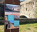
Information board


See also
Web links
- Ansignan Aqueduct - Photos + Info (French)
- Ansignan Aqueduct - Photos + Info (French)
- Photos + info - Aqueduct of Ansignan (English)
Individual evidence
- ↑ Pont-aqueduc sur l'Agly, Ansignan in the Base Mérimée of the French Ministry of Culture (French)