Arnsberg (Thuringian Rhön)
| Arnsberg | ||
|---|---|---|
|
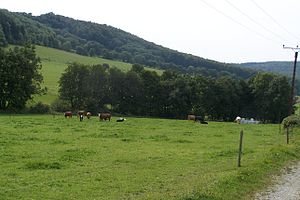
View over the pastures of Gerstengrund towards Arnsberg. |
||
| height | 661.4 m above sea level NHN | |
| location | near Brunnhartshausen , Wartburgkreis , Thuringia , Germany | |
| Mountains | Rhön | |
| Dominance | 1.4 km → Zellerkopf | |
| Notch height | 30 m | |
| Coordinates | 50 ° 41 '20 " N , 10 ° 3' 58" E | |
|
|
||
The Arnsberg is 661.4 m above sea level. NHN high mountain in the Thuringian Rhön near Brunnhartshausen in the Wartburg district , around 2.7 km northwest of the town center.
The Arnsberg, which is wooded in the summit area, appears as a little pronounced elevation in the ridge that extends south from the Sachsenburg .
For tourism, the Arnsberg is accessed from the Rhön-Höhen-Weg , which leads directly east of the summit over the Arnsberg.
The Arnsberg in the Thuringian Rhön should not be confused with the Arnsberg (Bavarian Rhön) near Bischofsheim or the Arnsberg (Steinbach-Hallenberg) in the Thuringian Forest.

