Artashat
|
Artashat Արտաշատ |
||
|
||
| State : |
|
|
| Province : | Ararat | |
| Coordinates : | 39 ° 57 ' N , 44 ° 33' E | |
| Height : | 831 m | |
| Area : | 10 km² | |
| Residents : | 25,308 (2008) | |
| Population density : | 2,531 inhabitants per km² | |
| Time zone : | UTC + 4 | |
| Telephone code : | (+374) 235 | |
| Postal code : | 0701-0706 | |
| Website : | ||
|
|
||
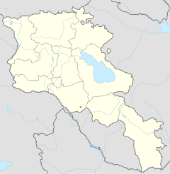
Artaschat ( Armenian Արտաշատ ) is the capital of the central Armenian province of Ararat a good 20 kilometers south of the state capital Yerevan , which is important as a trading center in the middle of the intensively agriculturally used Ararat plain. The name of the city, founded around 1828, is derived from the ancient capital Artaschat or Artaxata , the ruins of which are eight kilometers south of the monastery of Chor Virap .
location
Artaschat lies at an altitude of 831 meters in the alluvial valley plain of the Aras , the border river to Turkey. Immediately across the border rises the 5,137 meter high Ararat , from which the province and the plains around the city, criss-crossed by irrigation canals, have taken their name. The entire densely populated plain in the vicinity of the city is practically completely either converted into agricultural land or overbuilt with villages or individual farms. Fruit trees thrive, especially apricots and peaches, grapes, vegetables and tobacco. In the east, the Ararat plain turns into low hills, which are the foothills of the Geghama mountain range ( Geghama lehr ), which is up to 3597 meters high . Forests, which are protected as Chosrau National Park, have been preserved on the hills. They are named after the Arsakid ruler Chosrau II Kodak (Chosrau II the Little, ruled 330–338), who in 335 relocated his capital from ancient Artaschat further east to Dvin , where he had a forest set up as a royal hunting area.
Artashat is 29 kilometers away from Yerevan on the M2 leading to the south of the country, which has been converted into a motorway in this area . The only town halfway is Masis (14 kilometers north of Artashat). The nearest town to the south, Ararat , is eleven kilometers away on the M2. The city center is just under a kilometer east of the motorway exit on the parallel road H8. From Schahumian, the southern neighbor of Artaschat, along this parallel road to the north there are villages to Marmarashen at the level of the motorway exit to Masis, which have almost completely grown together. The first two villages north of this chain are Mrgavan and Berkanusch. In Berkanusch, a side road (H9) branches off to the east to the Dvin excavation site. Verin Artaschat (4462 inhabitants) is the name of a village adjacent to Dvin. Some villages were inhabited by Azerbaijanis until their forced relocation around 1950 during the Soviet rule . After that they were taken over by the Armenians .
The city has a train station on the Yerevan – Jolfa railway line, which opened in 1908 . One train per day goes to Yerevan and back for passenger transport.
Cityscape
After the last Russo-Persian War 1826–1828, which was fought over the Armenian territories and which ended with a Persian defeat, the Armenians and Assyrians had to flee Iran. On the site of an older village, some of them founded a settlement around 1828. Today's city is the result of planning from the Soviet era. In January 2008, according to official statistics, there were 25,308 inhabitants in Artashat.
The central axis across the city is the H8. It is about half a kilometer long and forms the main shopping street with mostly small grocery stores in two-story houses. A tree-lined park, which was set up in 2004, is attached to the central square with administration buildings and a large hotel. The four to five-storey apartment blocks in the city center are giving way to rural settlement forms with single-family houses and gardens away from the main roads. In the area between the H8 and the autobahn, some industrial companies have settled outside the center, including a porcelain factory that produces tiles. In the city or nearby, some companies process the grapes grown in the surrounding fields into wine and brandy (wine: Artashat Winery , brandy: Proshyan Brandy Factory , wine and brandy: Great Valley ). There is a university, a music school, a cultural center and a theater.
Web links
- Rick Ney: Ararat marz. Tour Armenia, 2012, p. 22f
Individual evidence
- ↑ a b Rick Ney: Ararat marz , p. 22
- ↑ Schedule of the daily electric clock train Yerevan - Ararat - Yerevan. From 11.12.2014 every day. www.ukzhd.am
- ^ RA Ararat March. armstat.am, 2008, p. 215


