Asahi (river)
|
Asahi Asahi-gawa |
||
| Data | ||
| location |
|
|
| River system | Asahi | |
| Headwaters | below the Utsumi Pass 35 ° 16 ′ 18 ″ N , 133 ° 36 ′ 4 ″ E |
|
| Source height | approx. 600 m | |
| muzzle |
Seto Inland Sea Coordinates: 34 ° 36 '2 " N , 133 ° 58' 21" E 34 ° 36 '2 " N , 133 ° 58' 21" E |
|
| Mouth height | 0 m | |
| Height difference | approx. 600 m | |
| Bottom slope | approx. 4.2 ‰ | |
| length | 142 km | |
| Catchment area | 1810 km² | |
| Outflow A Eo : 1810 km²
|
MQ Mq |
57 m³ / s 31.5 l / (s km²) |
| Left tributaries | Yashiro, Tanjoji | |
| Right tributaries | Shinjo, bitchu | |
| Reservoirs flowed through | Yubara Dam , Asahigawa Dam | |
| Big cities | Okayama | |
| Medium-sized cities | Maniwa | |
| Residents in the catchment area | approx. 330,000 | |
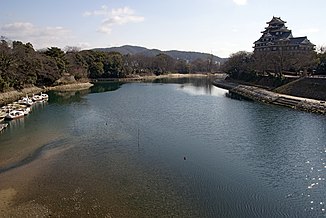
The Asahi ( Japanese 旭川 Asahi-gawa ) is a 142 km long river in Okayama Prefecture in the southwest of the island of Honshū in Japan . Along with Yoshii and Takahashi, it is one of three major rivers that flow through Okayama .
River course
The Asahi rises below the Utsumi pass at an altitude of about 600 m . It flows in a predominantly south-southeast direction through Okayama Prefecture. He meanders through the mountains. The city of Maniwa is at river kilometer 85 . On the lower 17 kilometers, the Asahi flows through the Okayama metropolitan area. The river eventually flows into the Seto Inland Sea .
Hydrology
The catchment area of the Asahi covers an area of 1810 km². The mean discharge is 57 m³ / s.
Use of hydropower
The Yubara Dam ( ⊙ ) lies on the upper reaches of the Asahi at river kilometer 114 . It dams the river over a length of about 9 km.
At a weir ( ⊙ ) at river kilometer 110, part of the water is fed to the Chugokudenryoku Katsuyama Daiichi hydropower plant ( ⊙ ) via an underground pipe with two adjoining pressure pipes . Below this, the water returns to the Asahi, which is dammed up at river kilometer 98.
The Asahigawa Dam ( ⊙ ) is located at river kilometer 56 . It dams the river over a length of about 6 km. 2.7 km below the dam there is a smaller dam that regulates the downstream flow.
Furthermore, there are several weirs along the Asahi, at which the water is fed to a small hydropower plant via a channel along the river bank below.
![]() Map with all coordinates: OSM | WikiMap
Map with all coordinates: OSM | WikiMap
Individual evidence
- ↑ a b Information from the Ministry of Land, Infrastructure, Transport and Tourism. Retrieved April 24, 2019 (jp).

