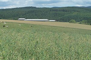
Aschenberg (Salzunger Werrabergland)
| Aschenberg | ||
|---|---|---|
|
View from the west |
||
| height | 452.1 m above sea level HN | |
| location | Thuringia ( Germany ) | |
| Dominance | 1.75 km → Castle Hill | |
| Notch height | 60 m ↓ sand channel | |
| Coordinates | 50 ° 48 '16 " N , 10 ° 21' 38" E | |
|
|
||
| rock | Red sandstone | |
The Aschenberg is a 452.1 m high mountain in the Salzunger Werrabergland in the district of Bad Liebenstein .
The almost completely wooded Aschenberg consists of red sandstone ; its neighbor, the Burgberg, already comes from the Zechstein of the Liebenstein Zechstein belt . Between the two is the location of Bad Liebenstein with the Liebensteiner disturbance , the existence of which the Liebensteiner Heilquelle owes its origin. Whether the name "Aschenberg" is derived from the weathered sandstone or from the earlier occurrence of ash trees is a matter of dispute.
There is a hiking trail around the Aschenberg, the Panoramaweg, which offers various views of the city, the Rhön or the Thuringian Forest . The refuge of the men's choir "Sängerkranz" Bad Liebenstein eV is located on the cowshed, an open space near the summit. The Karl-Bücher monument is also located on the Aschenberg .
During a nameless winter storm through the high pressure area "Irenäus" on the night of 17./18. March 2018 saw a widespread wind break on the predominant spruce trees , so that large parts of the northeastern area (near the city) are now bare.
literature
- Roland Geißler : hiking guide to Bad Liebenstein and the Inselsberg , Rockstuhl Bad Langensalza, ISBN 978-3-93-8997-79-6
- Topographic hiking map Bad Liebenstein / Brotterode , State Office for Surveying and Geoinformation, ISBN 3-86140-741-8
Individual evidence
- ↑ Official topographic maps of Thuringia 1: 10,000. Wartburgkreis, district of Gotha, district-free city of Eisenach . In: Thuringian Land Survey Office (Hrsg.): CD-ROM series Top10 . CD 2. Erfurt 1999.
- ↑ insuedthueringen.de: Storm shaves off Aschenberg

