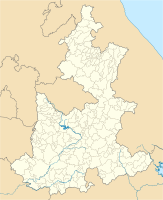
Atlixco
| Atlixco | ||
|---|---|---|
|
Coordinates: 18 ° 54 ' N , 98 ° 27' W Atlixco on the map of Puebla
|
||
| Basic data | ||
| Country | Mexico | |
| State | Puebla | |
| Municipio | Atlixco | |
| Residents | 86,690 (2010) | |
| City insignia | ||
| Detailed data | ||
| height | 1835 m | |
| Post Code | 74200 | |
| prefix | 244 | |
| City Presidency | José Luis Galeazzi | |
| Website | ||
| Panorama of Atlixco | ||
Atlixco is a city in the state of Puebla , in the highlands of Mexico . Atlixco is the administrative seat of the municipality of Atlixco of the same name
The city with 86,690 inhabitants (2010) is located in the Valle de Cristo and is characterized by a mild subtropical climate . The agricultural area is divided into two large areas: the irrigation areas and the arid areas . Accordingly, there are different agricultural uses. In the irrigation area along the Río Atoyac , there is intensive forage cultivation ( alfalfa ) with dairy farming . Flowers, saplings and vegetables are also grown. A specialty is the cultivation of avocados ( aguacate ), which on the large ranchos are often combined with leisure functions (swimming pool, weekend house).
history
In 1521 the inhabitants of the city no longer wanted to be subjects and tribute payers of the Aztecs . They allied themselves with the Spanish conquistadors and helped Hernán Cortés against their former oppressors in the siege of Tenochtitlán .


