Aufhofen (Egling)
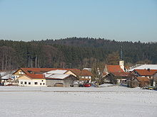
Aufhofen is part of the municipality of Egling in the Bad Tölz-Wolfratshausen district . The church village lies in a north-south direction between Munich and Bad Tölz and in an east-west direction between Wolfratshausen and Sauerlach .
The place has about 190 inhabitants. Aufhofen used to belong to the municipality of Thanning. As part of the regional reform , Thanning was merged with four other municipalities to form the new municipality of Egling on January 1, 1973 .
history
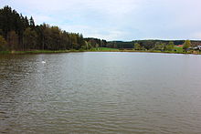
Aufhofen has been mentioned as a branch of the Thanning parish since 1315. Aufhofen was once a noble Hofmark and held a special legal position in the Wolfratshausen district court. The Hofmark was not one of the most important in Bavaria, because it did not have a castle, but only a mansion (today's Herrnbauer). The forest behind the pond was once owned by a manor house, a private hunter looked after the stately hunt, and the hunter's house later became the hunter host . The pond was built in 1721/22 by the then abbot of the Schäftlarn monastery . For this purpose, the Almbach, which rises east of the pond, was dammed, which today leaves the Aufhofener Weiher at the west end and is piped towards the inlet ditch shortly before Dettenhausen. In earlier times it was the main inlet of the Deininger pond.
Like many Hofmarksdörfer, Aufhofen was rich in handicrafts. Old farm names like Beim Hafnergütl , Beim Schneidergütl , Beim Bergschuster , Beim Sattlergütl , Beim Schmied , Beim Webergütl , Beim Schuhmachergütl and Beim Kalköfler are reminiscent of this . The noble lords, who were landlords and court lords in their Hofmark, were evidently well served.
Filial church Sankt Valentin
The oldest part of St. Valentine's Church was built in 1408. A certificate attests to the consecration on August 24, 1408. Around 1705 a new nave was probably built. The tower was rebuilt in 1767/68. In 1770 the church was painted in bright colors.
Soil monuments
Individual evidence
- ^ Federal Statistical Office (ed.): Historical municipality directory for the Federal Republic of Germany. Name, border and key number changes in municipalities, counties and administrative districts from May 27, 1970 to December 31, 1982 . W. Kohlhammer, Stuttgart / Mainz 1983, ISBN 3-17-003263-1 , p. 568 .
Web links
- Aufhofen in the location database of the Bayerische Landesbibliothek Online . Bavarian State Library
Coordinates: 47 ° 56 ' N , 11 ° 32' E


