Bass Rock (Greenland)
| Bass rock | ||
|---|---|---|
| Bass Rock as Bass Cliff northeast of Lille Pendulum on a map from 1874 | ||
| Waters | Greenland Sea | |
| Archipelago | Pendulum Islands | |
| Geographical location | 74 ° 43 ′ 0 ″ N , 18 ° 16 ′ 0 ″ W | |
|
|
||
| length | 990 m | |
| width | 560 m | |
| surface | 30 ha | |
| Highest elevation | 142 m | |
| Residents | uninhabited | |
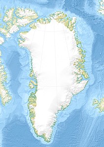
Bass Rock ( German also Bass Klippe ) is a rocky island in the Northeast Greenland National Park and belongs to the Pendulum Islands .
geography
As the easternmost island of the group, Bass Rock is about 800 meters off Cape Hartlaub on Lille Pendulum Island . To the east of the island, the Sirius Water Polynja , a usually ice-free marine area, stretches from the island of Shannon in the north to Hvalrosø in the south-west and provides good living conditions for the seabirds that breed here . Bass Rock is 142 meters high.
history
The British Douglas Charles Clavering was the first European to reach the Pendulum Islands in 1823 with the HMS Griper . He named the group after the pendulum seconds with which Edward Sabine carried out gravity field measurements here , and the striking rocky land after the famous rock in the Scottish Firth of Forth , which it reminded him of. In 1901 Evelyn Briggs Baldwin had two octagonal huts built on Bass Rock and filled with supplies for his planned expedition from Franz Josef Land across the geographic North Pole to the east coast of Greenland . Baldwin's foray to the Pole never took place, but the huts and supplies saved Ejnar Mikkelsen , a member of his expedition, ten years later. Mikkelsen and a comrade were looking for the missing Ludvig Mylius-Erichsen themselves and had to hibernate twice in northeast Greenland. After using the huts on Bass Rock in the winter of 1911/12, he was found there by the crew of the Norwegian steamer Sjøblimsten . Of the huts that still stand on the island today, one is in good condition and is the oldest usable building in northeast Greenland.
Individual evidence
- ↑ JBT Pedersen, LH Kaufmann, A. Kroon, BH Jakobsen: The Northeast Greenland Sirius Water Polynya dynamics and variability inferred from satellite imagery. ( Memento of February 2, 2014 in the Internet Archive ) In: Danish Journal of Geography 110, No. 2, 2010, pp. 131–142 (PDF; 3.5 MB; English).
- ↑ Sailing Directions. Pub. 181: Greenland and Iceland (Enroute) (PDF; 5.5 MB), Ninth Edition, National Geospatial-Intelligence Agency, Springfield, Virginia, 2011, p. 123 (English)
- ↑ a b Bass Rock . In: Anthony K. Higgins: Exploration history and place names of northern East Greenland. (= Geological Survey of Denmark and Greenland Bulletin 21, 2010). Copenhagen 2010, ISBN 978-87-7871-292-9 (English), accessed January 27, 2014
- ^ William James Mills: Exploring Polar Frontiers - A Historical Encyclopedia . tape 2 . ABC-CLIO, 2003, ISBN 1-57607-422-6 , pp. 429 ( limited preview in Google Book search).
- ↑ Field report from the journey to Northeast Greenland in the summer of 2004 (PDF; 2.5 MB), Nordøstgrønlandsk Kompagni NANOK, 2004

