Lille Pendulum
| Lille Pendulum | ||
|---|---|---|
| Small Pendulum Island on a map from 1874 | ||
| Waters | Greenland Sea | |
| Archipelago | Pendulum Islands | |
| Geographical location | 74 ° 40 ′ N , 18 ° 28 ′ W | |
|
|
||
| length | 13 km | |
| width | 5.5 km | |
| surface | 57.84 km² | |
| Highest elevation | Sonnenkopf 602 m |
|
| Residents | uninhabited | |
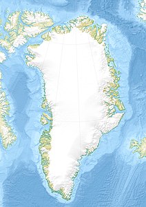
Lille Pendulum ( German also "Small Pendulum Island" or "Small Pendulum" ) is an uninhabited island off the east coast of Greenland in the Greenland Sea . Administratively, it belonged to the province of Tunu ("East Greenland") until the end of 2008 , and since 2009 to the non-parish area of the Northeast Greenland National Park .
geography
Lille Pendulum, together with the Sabine Island located 5 km to the southwest and some smaller islets and cliffs, forms the group of islands of the Pendulum Islands . These are located northeast of the Wollaston Forland peninsula and form the southern boundary of Hochstetterbucht. About 30 km north is the island of Shannon . East of Lille Pendulum is caused by regular winds, the pack ice of coastal fast ice drift away, one of the largest polynyas East Greenland, usually to Shannon Hvalrosø south of Sabine Island ranges.
Between Cape Desbrowe in the south and Cape Buchenau in the north, Lille Pendulum has an extension of 13 km. It is consistently 5 to 5.5 km wide, with the exception of its far protruding northeastern tip Cape Hartlaub. In the Sonnenkopf the island reaches its highest point at 602 m.
history
The Pendulum Islands had been settled for several thousand years, first by Paleo-Eskimos of the Independence I and later by Inuit of the Dorset and Thule cultures . Dwellings attributable to the Thule culture have been found on Lille Pendulum. When the first Europeans set foot on the island, they were already deserted.
Lille Pendulum has certainly been sighted by various whalers as early as the 17th century , in particular by William Scoresby , who in 1822 created the first map of the Greenland coast between the 69th and 75th parallel north. The actual discovery of the island by Europeans dates back to August 1823. In 1818 the British Admiralty had started a program to determine the exact shape of the earth using the pendulum-seconds . Specially trained naval officers traveled on the British ships and carried out pendulum experiments in remote parts of the British Empire. Among them was Edward Sabine , who later became President of the Royal Society . He had already accompanied the expeditions of John Ross and William Edward Parry to the discovery of the Northwest Passage in 1818 and 1819–1820 . In 1823 he drove on the HMS Griper under the command of Douglas Clavering to Hammerfest , Spitzbergen and the east coast of Greenland. After the Griper had passed the ice barrier of the East Greenland Current in the second week of August, she sailed north and reached the Pendulum Islands in mid-August 1823, the name of which is reminiscent of Sabine's pendulum experiments. However, Sabine did not carry it out on Lille Pendulum, but on the observatory peninsula on Sabine Island, which Clavering had initially called Inner Pendulum Island .
1869–1870 the Second German North Polar Expedition wintered with the screw steamer Germania in the Germaniahafen, a bay on Sabine Island. From here the expedition members, above all Julius Payer , undertook long boat trips and dog sledding trips to explore and map the adjacent coasts and also visited Lille Pendulum. Many geographical names on the island go back to the leader of the expedition, Carl Koldewey .
On July 12, 1926, the Cambridge-East Greenland expedition, led by James Wordie, visited Lille Pendulum and then repeated Sabine's pendulum experiments from 1823 on the neighboring island.
See also
Individual evidence
- ↑ JBT Pedersen, LH Kaufmann, A. Kroon, BH Jakobsen: The Northeast Greenland Sirius Water Polynya dynamics and variability inferred from satellite imagery. ( Memento of February 2, 2014 in the Internet Archive ) In: Danish Journal of Geography 110, No. 2, 2010, pp. 131–142 (PDF; 3.5 MB; English).
- ↑ Sonnenkopf . In: Anthony K. Higgins: Exploration history and place names of northern East Greenland. (= Geological Survey of Denmark and Greenland Bulletin 21, 2010). Copenhagen 2010, ISBN 978-87-7871-292-9 (English), accessed December 28, 2013
- ↑ The GeoArk 2008 expedition to North East Greenland on the National Museum of Denmark website, accessed April 25, 2014
- ↑ The second German North Pole voyage in 1869 and 1870 under the leadership of Captain Koldewey . Association for the German North Pole Trip in Bremen, Volume 1, Brockhaus, Leipzig 1874, p. 597
- ↑ Anthony K. Higgins: Exploration history of northern East Greenland (PDF; 2.9 MB). In: Exploration history and place names of northern East Greenland (= Geological Survey of Denmark and Greenland Bulletin 21, 2010), ISBN 978-87-7871-292-9 . P. 20 (English)
- ↑ WJ Mills: Exploring Polar Frontiers - A Historical Encyclopedia , Vol. 1, ABC-CLIO, 2003. ISBN 1-57607-422-6 , p. 148f (English)
- ↑ Edward Sabine: An account of experiments to determine the figure of the earth by means of the pendulum vibrating seconds in different latitudes; as well as on various other subjects of philosophical inquiry . John Murray, London 1825, pp. 159ff
- ↑ Anthony K. Higgins: Exploration history of northern East Greenland (PDF; 2.9 MB). In: Exploration history and place names of northern East Greenland (= Geological Survey of Denmark and Greenland Bulletin 21, 2010), ISBN 978-87-7871-292-9 . P. 34 (English)

