Beartooth Highway
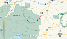
The Beartooth Highway is a 111 km (69 mile) long all-American road between the towns of Red Lodge , Montana, and Cooke City , Montana, immediately adjacent to the northeast entrance to Yellowstone National Park .
It leads from the upper river valley of Rock Creek over the Beartooth Mountains to the southern upper reaches of the Clarks Fork Yellowstone River . The middle section of the route is in the US state of Wyoming and reaches an altitude of 3336 m (10.947 feet) at the Beartooth Pass . Due to its altitude and the adverse effects of snowfall, the pass is usually only open between May and October. The highway is part of US Route 212 .
On May 8, 2014, the route was added to the National Register of Historic Places as a cultural monument .
Web links
Individual evidence
- ^ Beartooth Highway Points of Interest , Red Lodge Montana Chamber of Commerce. Retrieved June 29, 2014.
- ^ Beartooth Highway Receives Prestigious National Register Listing. National Park Service, June 20, 2014, accessed June 21, 2014 .


