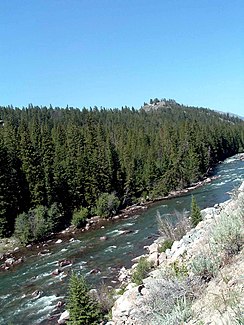
Clarks Fork Yellowstone River
|
Clarks Fork Yellowstone River Clarks Fork |
||
|
Upper reaches of the Clarks Fork Yellowstone River |
||
| Data | ||
| Water code | US : 798974 | |
| location |
Montana , Wyoming ( United States ) |
|
| River system | Mississippi River | |
| Drain over | Yellowstone → Missouri → Mississippi → Gulf of Mexico | |
| Confluence of | West Fork Clarks Fork and Broadwater River on the southern flank of the Beartooth Mountains ( Rocky Mountains ) 45 ° 1 ′ 23 ″ N , 109 ° 52 ′ 6 ″ W |
|
| Source height | approx. 2431 m | |
| muzzle |
Yellowstone River Coordinates: 45 ° 39 '3 " N , 108 ° 42' 54" W 45 ° 39 '3 " N , 108 ° 42' 54" W. |
|
| Mouth height | 988 m | |
| Height difference | approx. 1443 m | |
| Bottom slope | approx. 6.6 ‰ | |
| length | approx. 220 km | |
| Catchment area | approx. 7210 km² | |
| Discharge at the Silesia A Eo gauge : 5462 km² Location: 25 km above the mouth |
MQ 1970/1986 Mq 1970/1986 |
32.4 m³ / s 5.9 l / (s km²) |
| Left tributaries | Rock Creek | |
| Right tributaries | Sunlight Creek | |
| Communities | Bridger , Fromberg | |
| National Wild and Scenic River (20 miles wild ) | ||
|
Location of Clarks Fork in the Yellowstone River system |
||
The Clarks Fork Yellowstone River , or Clarks Fork for short , is an approximately 220 km long right tributary of the Yellowstone River in the US states of Montana and Wyoming .
River course
The Clarks Fork Yellowstone River arises 5 km east of Cooke City-Silver Gate on the southern flank of the Beartooth Mountains , a mountain range of the Rocky Mountains , in the central south of Montana not far from the border with Wyoming at the confluence of its two headwaters, the West Fork Clarks Fork and Broadwater River . The Clarks Fork Yellowstone River initially flows 60 km to the southeast. He crosses the border into Wyoming. Then it turns 30 km to the northeast and finally it turns to the north-northeast. He's crossing the border into Montana. The Clarks Fork Yellowstone River finally flows 5 km southeast of the small town of Laurel into the Yellowstone River. The upper reaches of the river are in the Gallatin National Forest in Montana and the Shoshone National Forest in Wyoming. The Wyoming Highway 296 (Chief Joseph Scenic Byway) and the Beartooth Highway ( US Highway 212 ) run along the upper reaches of the river. A 33 km stretch of river below the Crandall Creek Bridge was added to the National Wild and Scenic River System in the wild in 1990.
Hydrology
The Clarks Fork Yellowstone River drains an area of about 7210 km². The mean discharge at the gauge near Silesia, 25 km above the mouth, is 32.4 m³ / s. The river carries the most water during the snowmelt in June with a monthly average of 126 m³ / s.
Web links
Individual evidence
- ↑ West Fork Clarks Fork in the Geographic Names Information System of the United States Geological Survey
- ↑ Clarks Fork Yellowstone River in the Geographic Names Information System of the United States Geological Survey
- ↑ USGS 06214050 Clarks Fork Yellowstone River nr Laurel MT
- ↑ a b USGS 06208800 Clarks Fork Yellowstone River nr Silesia MT
- ^ Yellowstone River (Clarks Fork), Wyoming . National Wild and Scenic Rivers System. Retrieved August 23, 2018.
- ↑ Comprehensive River Management Plan for the Clarks Fork of the Yellowstone Wild and Scenic River (PDF, 247 KB) National Wild and Scenic Rivers System. September 2009. Accessed August 23, 2018.

