Beascochea Bay
| Beascochea Bay | ||
|---|---|---|
|
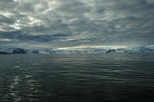
View from Beascoche Bay to the west coast of Grahamland |
||
| Waters | Grandidier Canal | |
| Land mass | Grahamland , Antarctic Peninsula | |
| Geographical location | 65 ° 30 ′ S , 64 ° 0 ′ W | |
|
|
||
| width | 8 kilometers | |
| depth | 16 km | |
| Islands | King Island | |
| Tributaries | Butamja Glacier , Cadman Glacier , Lever Glacier , Talew Glacier | |
The Beascochea Bay ( French Baie Beascochea , Spanish Bahía Beascochea , English Beascochea Bay ) is a bay on the Graham coast of Graham Land on the Antarctic Peninsula . It is located south of Cape Pérez and north of the Barison Peninsula .
The bay was discovered but insufficiently described in 1898 by participants in the Belgica expedition (1897–1899) led by the Belgian polar explorer Adrien de Gerlache de Gomery . Another sighting followed during the Fourth French Antarctic Expedition (1903-1905) under the direction of Jean-Baptiste Charcot . Charcot named the bay after the Argentine hydrographer Mariano Beascochea (1869–1943), who helped his 1904 expedition to Ushuaia .
Web links
- Beascochea Bay in the Geographic Names Information System of the United States Geological Survey (English)
- Beascochea Bay on geographic.org (English)

