Beder Malling
| Beder | ||||
|
||||
| Basic data | ||||
|---|---|---|---|---|
| State : |
|
|||
| Region : | Midtjylland | |||
|
Municipality (since 2007) : |
Aarhus | |||
| Coordinates : | 56 ° 4 ' N , 10 ° 13' E | |||
|
Population : (2020) |
8,898 | |||
 map |
||||
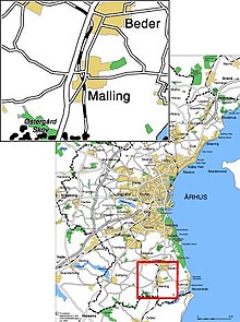
Beder-Malling is a Danish satellite town in the southern part of Aarhus Municipality and belongs to the Midtjylland region . It has 8,898 inhabitants (as of January 1, 2020) and is located about 15 kilometers south of the center of Aarhus .
The two cities of Beder and Malling have been listed as a common city in Denmark's statistics since January 1, 2013.
On January 1, 2017, the combined municipality had 9,790 inhabitants.
Web links
Commons : Beder-Malling - collection of images, videos and audio files
Individual evidence
- ↑ a b Statistics Banks -> Befolkning og valg -> BY1: Folketal January 1st efter byområde, alder og køn (Danish)
- ↑ Hele befolkningen i Aarhus Kommune January 1, 2017. (PDF) (No longer available online.) In: aarhus.dk. P. 7 , archived from the original on August 29, 2018 ; accessed on August 28, 2018 (Danish). Info: The archive link was inserted automatically and has not yet been checked. Please check the original and archive link according to the instructions and then remove this notice.
- ↑ municipality plan Aarhus. Retrieved May 29, 2018 (Danish).

