Beegden
 flag |
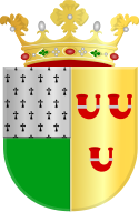
 coat of arms |
| province |
|
| local community |
|
|
Area - land - water |
8.14 km 2 7.33 km 2 0.81 km 2 |
| Residents | 1,748 (Jan 1, 2018) |
| Coordinates | 51 ° 11 ′ N , 5 ° 55 ′ E |
| Important traffic route |
|
| prefix | 0475 |
| Postcodes | 6041, 6085, 6095, 6097, 6099 |
| Location of Beegden in the municipality of Maasgouw | |
The Dutch town of Beegden has been part of the Limburg municipality of Maasgouw since 2007 and is located on the left bank of the Maas approx. 10 km southwest of the city of Roermond . The place has 1,748 inhabitants (as of January 1, 2018) and is only 7 to 10 meters above sea level.
In the still partly agricultural town, tourism near the popular shopping town of Roermond and the water sports on the Maas play a very important role.
Beegden was an independent municipality until it was incorporated into Heel municipality in 1991 . With this the place came in 2007 to the new municipality Maasgouw.
politics
Distribution of seats in the municipal council
Until the municipality was dissolved, the following distribution of seats had been made since 1982:
| Political party | Seats | |
|---|---|---|
| 1982 | 1986 | |
| Lijst Evers | 2 | 3 |
| Leefbaar Beegden a | 2 | 2 |
| Lijst Peeters | 1 | 2 |
| Lijst Berendsen | 2 | - |
| Lijst Schreurs | 0 | - |
| Lijst Rulkens | 0 | - |
| total | 7th | 7th |
a In 1982 the Leefbaar Beegden party ran under the name "Lijst Welles-Scholtz".
Web links
Commons : Beegden - collection of images, videos and audio files
Individual evidence
- ↑ a b Cijfers en feiten Gemeente Maasgouw, accessed on August 7, 2018 (Dutch)
- ↑ Allocation of seats in the municipal council: 1982–1986 , accessed on August 7, 2018 (Dutch)
