Bellerive (Tasmania)
| Bellerive | |||||||
|---|---|---|---|---|---|---|---|
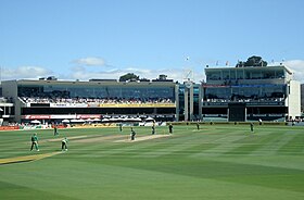
 Bellerive Oval with members 'pavilion and reporters' booths |
|||||||
|
|||||||
|
|||||||
|
|||||||
|
|||||||
|
|
|||||||
Bellerive is a suburb of Hobart in the southeast of the Australian state of Tasmania with 4507 inhabitants (as of 2016).
location
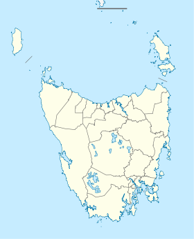
It is located about 5 km east of the city center on the east bank of the Derwent River and belongs to the Local Government Area Clarence City . The suburb stretches from Kangaroo Bay , where it borders Rosny , around the curving shoreline of Bellerive Esplanade to Kangaroo Bluff , then down Bellerive Beach and east to Second Bluff , where it borders Howrah . To the north, Bellerive ends on the low hills of Waverly Flora Park .
history
Bellerive was first settled in the 1820s and was then called Kangaroo Point , as there were always many kangaroos to be seen on the coast . Before that time, there was a ferry from Hobart that regularly docked in the area. After the first settlers settled, the community developed quickly. Soon there were roads to the Clarence Plains farms , to Rokeby , to the Coal River to Richmond, and to Hollow Tree in Cambridge . Since the 1830s, the settlement was called Bellerive (English: beautiful bank), and many boats crossed the Derwent River to Sullivans Cove on the other side of the river every day .
Historic Buildings
The area around Bellerive Quay and the promenade almost has the character of a village. There are many historical buildings there, some of which are from the early 19th century. The Clarence Hotel - built in 1879 - has long been both a social gathering place and a waiting room for ferry passengers. The old post office from 1897 now houses the Sound Preservation Museum and the Tasmanian Genealogical Society. At the end of Kangaroo Bluff is a British fort from 1885 called Kangaroo Battery , now a public park.
One of the oldest buildings still in existence in Bellerive is the old police station from 1842. It was built from sandstone broken in the area, is still largely original today and still has one of the first prison cells. The other cells made of shuttering boards are still there. Over the years the police station has been used for many purposes, it served as a meeting place for the city council, as a city library, as the headquarters of the criminal investigation department and today as an art gallery.
One of the greatest historical private buildings is the Natone House . It was written in 1863 for the Hobart judge Sir Valentine Fleming . He sold it in 1873 to James O'May , a ferry pioneer in Hobart. He added a rear building and a beautiful veranda to the house. Today it is on the Australian Monuments List.
From 1892 to 1926 the Bellerive-Sorell Railway operated its terminus on an elongated quay that reached into the bay. Today this quay is part of the promenade.
Sports and public facilities
Bellerive is best known for its international cricket stadium , the Bellerive Oval . Sailing enthusiasts will find their home in the Bellerive Yacht Club , which has a marina on Bellerive Quay . Bellerive is also the eastern stop for the ferry to Hobart.
Web links
Individual evidence
- ↑ a b Australian Bureau of Statistics : Bellerive ( English ) In: 2016 Census QuickStats . June 27, 2017. Retrieved April 29, 2020.
